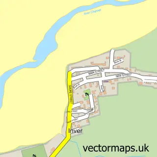
This Embo street map is a detailed vector street map covering a 750m x 750m area. Select a larger area to create and download your own vector street map of Embo.
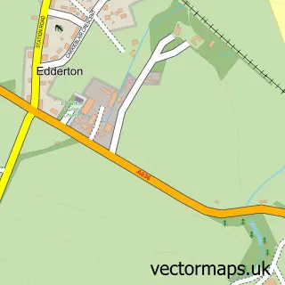
The 750-metre map sample for Embo covers 34 mapped buildings and approximately 10.2 km of road detail, of which 11 named roads are named. The wider area around Embo features 3 tourism points of interest, 1 food and drink venue and 1 campsite within 2 miles. To create a larger or custom map of Embo, the map builder lets you define your own coverage area and download editable SVG, PDF and PNG files.
Create a larger editable map of Embo
Choose any area you need and generate a high-quality vector map instantly. Perfect for print, planning, design, business and personal use.

This Embo street map in Sutherland is available as downloadable SVG, PDF and PNG map files, or as a printed map for planning, business, display, education, local information and design work. You can also create a larger custom map area using the map selector.
What this Embo map sample shows
Embo lies within Highland parish, part of East Sutherland And Edderton ward in the Highland local authority area. The postcode geography for this area includes the IV postcode area, the IV25 postcode district and the IV25 3 postcode sector. Local NHS services are provided through Highland.
Local features near Embo
Within 2 milesAmenities and services in and around Embo.
Administrative and postcode information for Embo
Embo lies within Highland parish, part of East Sutherland And Edderton ward in the Highland local authority area. The postcode geography for this area includes the IV postcode area, the IV25 postcode district and the IV25 3 postcode sector. Local NHS services are provided through Highland.
Nearby street map samples around Embo

More street maps in Sutherland
750 metre map area coverage
Boundary, postcode and point of interest information for the 750m x 750m rectangle centred on this sample map.
Boundaries containing map centre
Constituency: Caithness, Sutherland and Easter Ross Co Const
District: Highland
Icb: Highland
Postcode District: IV25
Postcode Sector: IV25 3
Ward: East Sutherland and Edderton Ward
Nearby boundaries intersecting sample
No additional intersecting boundaries found.
Postcode coverage
POI category counts
Holiday Rental Home: 4
Campground: 2
Auto Electrical Repair: 1
Bar: 1
Beach: 1
Cabin: 1
Coffee Shop: 1
Ferry Boat Company: 1
Mobile Home Park: 1
Park: 1
Sample points of interest
- KGB Electrical
- Coast Bar & Kitchen
- Embo Beach, Sutherland, Scotland.
- Ceol na Mara
- Grannie's Heilan' Hame Holiday Park
- Park Dean Resorts
- Old School Cafe
- Embo Pier
- Embo, Grannies Helian Hame Caravan for Rent
- Highland Home at Embo
- No13 The Views, Embo Caravan Hire
- The Luxury Lodge at Grannies
Create a larger editable map of Embo
This sample shows only a 750 metre area. To create a larger map of Embo, use our map builder to choose your own coverage area, add titles and download editable SVG, PDF and PNG files.
Create a custom map of Embo