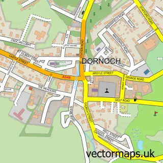
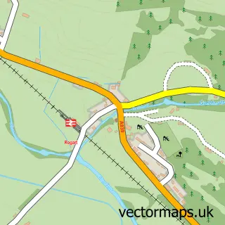
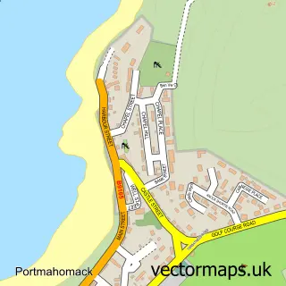
This Golspie street map is a detailed vector street map covering a 750m x 750m area. Select a larger area to create and download your own vector street map of Golspie.
The 750-metre map sample for Golspie covers 93 mapped buildings and approximately 9.5 km of road detail, of which 13 named roads are named. The immediate area includes 1 GP surgery and 1 pub. The wider area around Golspie features 1 tourism point of interest, 4 food and drink venues and 2 hotels. To create a larger or custom map of Golspie, the map builder lets you define your own coverage area and download editable SVG, PDF and PNG files.
Create a larger editable map of Golspie
Choose any area you need and generate a high-quality vector map instantly. Perfect for print, planning, design, business and personal use.

This Golspie street map in Sutherland is available as downloadable SVG, PDF and PNG map files, or as a printed map for planning, business, display, education, local information and design work. You can also create a larger custom map area using the map selector.
What this Golspie map sample shows
Golspie lies within Highland parish, part of East Sutherland And Edderton ward in the Highland local authority area. The postcode geography for this area includes the KW postcode area, the KW10 postcode district and the KW10 6 postcode sector. Residents fall under the Highland for NHS services.
Local features near Golspie
Within 2 milesAmenities and services in and around Golspie.
Administrative and postcode information for Golspie
Golspie lies within Highland parish, part of East Sutherland And Edderton ward in the Highland local authority area. The postcode geography for this area includes the KW postcode area, the KW10 postcode district and the KW10 6 postcode sector. Residents fall under the Highland for NHS services.
Nearby street map samples around Golspie

More street maps in Sutherland
750 metre map area coverage
Boundary, postcode and point of interest information for the 750m x 750m rectangle centred on this sample map.
Boundaries containing map centre
Constituency: Caithness, Sutherland and Easter Ross Co Const
District: Highland
Icb: Highland
Postcode District: KW10
Postcode Sector: KW10 6
Ward: East Sutherland and Edderton Ward
Nearby boundaries intersecting sample
No additional intersecting boundaries found.
Postcode coverage
POI category counts
Bed And Breakfast: 4
Convenience Store: 3
Dentist: 3
Charity Organization: 2
Coffee Shop: 2
Community Services Non Profits: 2
Doctor: 2
Drugstore: 2
Hotel: 2
Library: 2
Sample points of interest
- Arches Antiques and Art Gallery
- The Cooperative Food Golspie
- Community Banker Go Golspie Development Trust
- Golspie Beach
- Burnwood Bed and Breakfast
- Halladale
- Halladale Bed and Breakfast
- Rosedene B&B
- Robert Grant Butcher
- Poppy's cafe
- East Sutherland Canoe Club
- Lodge St. Andrew Masonic Hall
Create a larger editable map of Golspie
This sample shows only a 750 metre area. To create a larger map of Golspie, use our map builder to choose your own coverage area, add titles and download editable SVG, PDF and PNG files.
Create a custom map of Golspie