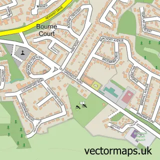
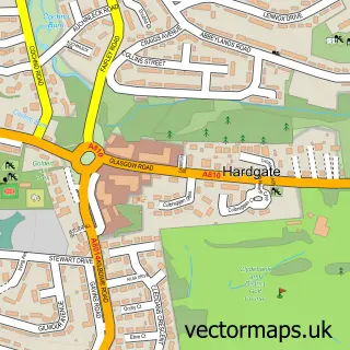
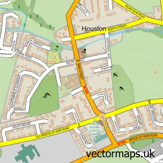
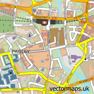
This Erskine street map is a detailed vector street map covering a 750m x 750m area. Select a larger area to create and download your own vector street map of Erskine.
The 750-metre map sample for Erskine covers 149 mapped buildings and approximately 14.1 km of road detail, of which 10 named roads are named. The immediate area includes 1 GP surgery, with 10 within 2 miles and 6 MOT stations within 2 miles. The wider area around Erskine features 2 tourism points of interest and 6 food and drink venues. To create a larger or custom map of Erskine, the map builder lets you define your own coverage area and download editable SVG, PDF and PNG files.
Create a larger editable map of Erskine
Choose any area you need and generate a high-quality vector map instantly. Perfect for print, planning, design, business and personal use.

This Erskine street map in Renfrewshire is available as downloadable SVG, PDF and PNG map files, or as a printed map for planning, business, display, education, local information and design work. You can also create a larger custom map area using the map selector.
What this Erskine map sample shows
Erskine lies within Renfrewshire parish, part of Erskine And Inchinnan ward in the Renfrewshire local authority area. The postcode geography for this area includes the PA postcode area, the PA8 postcode district and the PA8 6 postcode sector. Residents fall under the Greater Glasgow And Clyde for NHS services.
Local features near Erskine
Within 2 milesAmenities and services in and around Erskine.
Administrative and postcode information for Erskine
The local authority covering Erskine is Renfrewshire, within the county of Renfrewshire. The settlement lies within Erskine And Inchinnan ward and Renfrewshire civil parish. The PA8 postcode district and PA8 6 postcode sector serve the immediate area. NHS provision in the area is delivered through Greater Glasgow And Clyde.
Nearby street map samples around Erskine

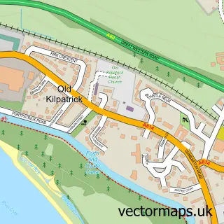
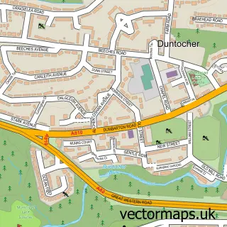
More street maps in Renfrewshire
750 metre map area coverage
Boundary, postcode and point of interest information for the 750m x 750m rectangle centred on this sample map.
Boundaries containing map centre
Constituency: Paisley and Renfrewshire North Burgh Const
District: Renfrewshire
Icb: Greater Glasgow and Clyde
Postcode District: PA8
Postcode Sector: PA8 7
Ward: Erskine and Inchinnan Ward
Nearby boundaries intersecting sample
Constituency: West Dunbartonshire Co Const
District: West Dunbartonshire
Postcode Sector: PA8 6
Ward: Clydebank Waterfront Ward
Postcode coverage
POI category counts
Coffee Shop: 4
Supermarket: 4
Church Cathedral: 3
Funeral Services And Cemeteries: 3
Key And Locksmith: 3
Package Locker: 3
Bar: 2
Building Supply Store: 2
Driving School: 2
Gas Station: 2
Sample points of interest
- Shell Erskine (2044)
- On The Road
- Greggs
- Bank Of Scotland
- Bridgewater Tavern
- Jades
- K2 Turkish Barbers
- Ladbrokes
- Advanced Plumbing & Heating - Services
- Emergency Plumber 24/7
- Mitchells of Erskine
- Cafe Unique
Create a larger editable map of Erskine
This sample shows only a 750 metre area. To create a larger map of Erskine, use our map builder to choose your own coverage area, add titles and download editable SVG, PDF and PNG files.
Create a custom map of Erskine