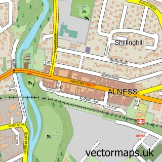
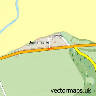
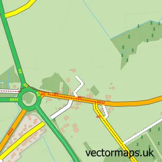
This Evanton street map is a detailed vector street map covering a 750m x 750m area. Select a larger area to create and download your own vector street map of Evanton.
The 750-metre map sample for Evanton covers 181 mapped buildings and approximately 14.6 km of road detail, of which 19 named roads are named. The wider area around Evanton features 1 tourism point of interest and 1 hotel. To create a larger or custom map of Evanton, the map builder lets you define your own coverage area and download editable SVG, PDF and PNG files.
Create a larger editable map of Evanton
Choose any area you need and generate a high-quality vector map instantly. Perfect for print, planning, design, business and personal use.

This Evanton street map in Ross and Cromarty is available as downloadable SVG, PDF and PNG map files, or as a printed map for planning, business, display, education, local information and design work. You can also create a larger custom map area using the map selector.
What this Evanton map sample shows
Evanton lies within Highland parish, part of Cromarty Firth ward in the Highland local authority area. The postcode geography for this area includes the IV postcode area, the IV16 postcode district and the IV16 9 postcode sector. Residents fall under the Highland for NHS services.
Local features near Evanton
Within 2 milesAmenities and services in and around Evanton.
Administrative and postcode information for Evanton
The local authority covering Evanton is Highland, within the county of Ross And Cromarty. The settlement lies within Cromarty Firth ward and Highland civil parish. The IV16 postcode district and IV16 9 postcode sector serve the immediate area. NHS provision in the area is delivered through Highland.
Nearby street map samples around Evanton

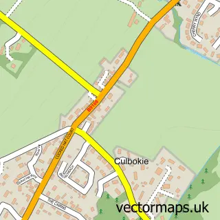
More street maps in Ross and Cromarty
750 metre map area coverage
Boundary, postcode and point of interest information for the 750m x 750m rectangle centred on this sample map.
Boundaries containing map centre
Constituency: Caithness, Sutherland and Easter Ross Co Const
District: Highland
Icb: Highland
Postcode District: IV16
Postcode Sector: IV16 9
Ward: Cromarty Firth Ward
Nearby boundaries intersecting sample
No additional intersecting boundaries found.
Postcode coverage
POI category counts
Community Services Non Profits: 2
Architect: 1
Art Gallery: 1
Atms: 1
Bakery: 1
Bed And Breakfast: 1
Campground: 1
Carpenter: 1
Catholic Church: 1
Charity Organization: 1
Sample points of interest
- Trevor Black Architects
- fyrish glass
- The Cooperative Food Evanton (ERF), Evanton
- Sweet Treats Evanton
- Badarroch Holiday Cottage
- Blackrock Caravan Park
- R S Joinery Services
- Kiltearn
- Blythswood Shops
- Victoria Diamond Jubilee Hall
- Evanton Wood Community Company
- United Texas Credit Union
Create a larger editable map of Evanton
This sample shows only a 750 metre area. To create a larger map of Evanton, use our map builder to choose your own coverage area, add titles and download editable SVG, PDF and PNG files.
Create a custom map of Evanton