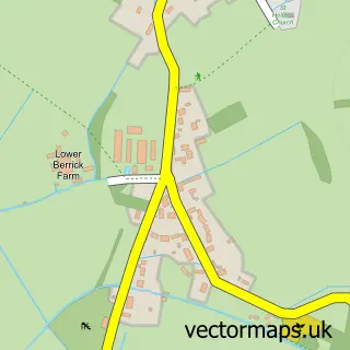
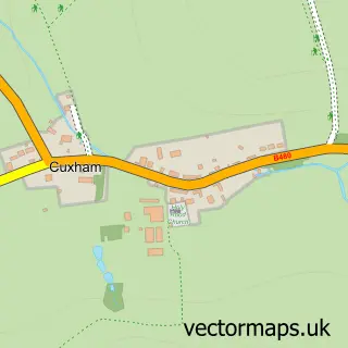
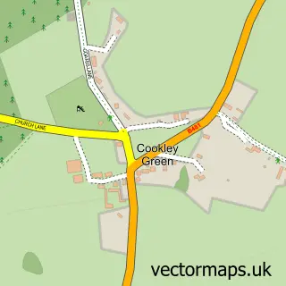
This Ewelme street map is a detailed vector street map covering a 750m x 750m area. Select a larger area to create and download your own vector street map of Ewelme.
The 750-metre map sample for Ewelme covers 155 mapped buildings and approximately 8.0 km of road detail, of which 8 named roads are named. The immediate area includes 1 school, 1 GP surgery within 2 miles and 2 MOT stations within 2 miles. The wider area around Ewelme features 1 hotel and 1 campsite within 2 miles. To create a larger or custom map of Ewelme, the map builder lets you define your own coverage area and download editable SVG, PDF and PNG files.
Create a larger editable map of Ewelme
Choose any area you need and generate a high-quality vector map instantly. Perfect for print, planning, design, business and personal use.

This Ewelme street map in Oxfordshire is available as downloadable SVG, PDF and PNG map files, or as a printed map for planning, business, display, education, local information and design work. You can also create a larger custom map area using the map selector.
What this Ewelme map sample shows
Ewelme lies within Ewelme Cp parish, part of Benson & Crowmarsh ward in the South Oxfordshire District local authority area. The postcode geography for this area includes the OX postcode area, the OX10 postcode district and the OX10 6 postcode sector. Residents fall under the Nhs Buckinghamshire, Oxfordshire And Berkshire West Integrated Care Board for NHS services.
Local features near Ewelme
Within 2 milesAmenities and services in and around Ewelme.
Administrative and postcode information for Ewelme
Ewelme lies within Ewelme Cp parish, part of Benson & Crowmarsh ward in the South Oxfordshire District local authority area. The postcode geography for this area includes the OX postcode area, the OX10 postcode district and the OX10 6 postcode sector. Residents fall under the Nhs Buckinghamshire, Oxfordshire And Berkshire West Integrated Care Board for NHS services.
Nearby street map samples around Ewelme

More street maps in Oxfordshire
750 metre map area coverage
Boundary, postcode and point of interest information for the 750m x 750m rectangle centred on this sample map.
Boundaries containing map centre
Constituency: Henley and Thame Co Const
County: Oxfordshire County
District: South Oxfordshire District
Icb: NHS Thames Valley ICB
Parish: Ewelme CP
Police Force: thames valley
Postcode District: OX10
Postcode Sector: OX10 6
Ward: Benson & Crowmarsh Ward
Nearby boundaries intersecting sample
No additional intersecting boundaries found.
Postcode coverage
POI category counts
Automotive Repair: 2
Preschool: 2
Anglican Church: 1
Business Consulting: 1
Car Dealer: 1
Convenience Store: 1
Cooking School: 1
Elementary School: 1
Financial Service: 1
Florist: 1
Sample points of interest
- Ewelme St Mary the Virgin
- Ewelme Garage
- Performance and Prestige Cars
- P D F
- Chris lees Specialists Cars Ltd
- Ewelme Village Store
- Wild Baker
- Ewelme C of E Primary School
- Cara Chapman Chartered Accountant
- The Bespoke Florist
- Rose and Grace Wedding Florist
- W E Edwards & Son
Create a larger editable map of Ewelme
This sample shows only a 750 metre area. To create a larger map of Ewelme, use our map builder to choose your own coverage area, add titles and download editable SVG, PDF and PNG files.
Create a custom map of Ewelme