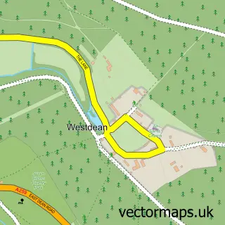
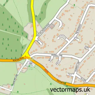
This Exceat street map is a detailed vector street map covering a 750m x 750m area. Select a larger area to create and download your own vector street map of Exceat.
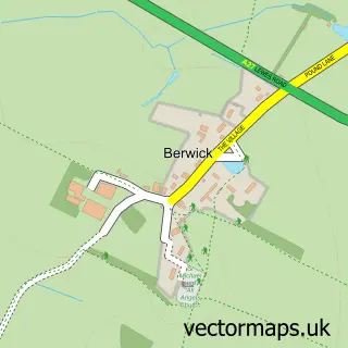
The 750-metre map sample for Exceat covers 7 mapped buildings and approximately 7.9 km of road detail, of which 2 named roads are named. The immediate area includes 1 pub and 1 MOT station within 2 miles. The wider area around Exceat features 3 tourism points of interest and 1 food and drink venue. To create a larger or custom map of Exceat, the map builder lets you define your own coverage area and download editable SVG, PDF and PNG files.
Create a larger editable map of Exceat
Choose any area you need and generate a high-quality vector map instantly. Perfect for print, planning, design, business and personal use.

This Exceat street map in East Sussex is available as downloadable SVG, PDF and PNG map files, or as a printed map for planning, business, display, education, local information and design work. You can also create a larger custom map area using the map selector.
What this Exceat map sample shows
Exceat lies within Cuckmere Valley Cp parish, part of South Downs ward in the Wealden District local authority area. The postcode geography for this area includes the BN postcode area, the BN25 postcode district and the BN25 4 postcode sector. Residents fall under the Nhs Sussex Integrated Care Board for NHS services.
Local features near Exceat
Within 2 milesAmenities and services in and around Exceat.
Administrative and postcode information for Exceat
The local authority covering Exceat is Wealden District, within the county of East Sussex. The settlement lies within South Downs ward and Cuckmere Valley Cp civil parish. The BN25 postcode district and BN25 4 postcode sector serve the immediate area. NHS provision in the area is delivered through East Sussex Healthcare Nhs Trust.
Nearby street map samples around Exceat

More street maps in East Sussex
750 metre map area coverage
Boundary, postcode and point of interest information for the 750m x 750m rectangle centred on this sample map.
Boundaries containing map centre
Constituency: Lewes Co Const
County: East Sussex County
District: Wealden District
Icb: NHS Surrey and Sussex ICB
Parish: Cuckmere Valley CP
Police Force: sussex
Postcode District: BN25
Postcode Sector: BN25 4
Ward: South Downs Ward
Nearby boundaries intersecting sample
District: Lewes District
Parish: Seaford CP
Ward: Seaford East Ward
Postcode coverage
POI category counts
Park: 2
Attractions And Activities: 1
Bed And Breakfast: 1
Bike Rentals: 1
Environmental Conservation Organization: 1
Ev Charging Station: 1
Pub: 1
Retail: 1
Sports Club And League: 1
Venue And Event Space: 1
Sample points of interest
- Buzz Active Cuckmere
- Saltmarsh Farmhouse & Cafe
- Cuckmere Cycle Company
- Sussex Wildlife Trust
- South Downs Seven Sisters
- Seven Sisters Country Park
- Seven Sisters Country Park
- Seven Sisters
- Sussex Wildlife Trust
- Cuckmere Valley Canoe Club
- Saltmarsh Farmhouse Rooms & Cafe
Create a larger editable map of Exceat
This sample shows only a 750 metre area. To create a larger map of Exceat, use our map builder to choose your own coverage area, add titles and download editable SVG, PDF and PNG files.
Create a custom map of Exceat