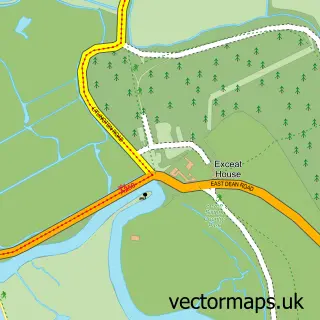
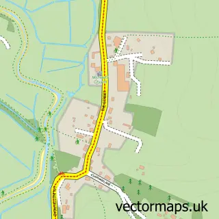
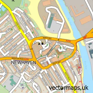
This Seaford street map is a detailed vector street map covering a 750m x 750m area. Select a larger area to create and download your own vector street map of Seaford.
The 750-metre map sample for Seaford covers 444 mapped buildings and approximately 25.2 km of road detail, of which 62 named roads are named. The immediate area includes 1 railway station, 2 GP surgeries, 5 pubs and 4 MOT stations, with 5 within 2 miles. The wider area around Seaford features 5 tourism points of interest and 29 food and drink venues. To create a larger or custom map of Seaford, the map builder lets you define your own coverage area and download editable SVG, PDF and PNG files.
Create a larger editable map of Seaford
Choose any area you need and generate a high-quality vector map instantly. Perfect for print, planning, design, business and personal use.

This Seaford street map in East Sussex is available as downloadable SVG, PDF and PNG map files, or as a printed map for planning, business, display, education, local information and design work. You can also create a larger custom map area using the map selector.
What this Seaford map sample shows
Seaford lies within Seaford Cp parish, part of Seaford Central ward in the Lewes District local authority area. The postcode geography for this area includes the BN postcode area, the BN25 postcode district and the BN25 2 postcode sector. Residents fall under the Nhs Sussex Integrated Care Board for NHS services.
Local features near Seaford
Within 2 milesAmenities and services in and around Seaford.
Administrative and postcode information for Seaford
Seaford lies within Seaford Cp parish, part of Seaford Central ward in the Lewes District local authority area. The postcode geography for this area includes the BN postcode area, the BN25 postcode district and the BN25 2 postcode sector. Residents fall under the Nhs Sussex Integrated Care Board for NHS services.
Nearby street map samples around Seaford

More street maps in East Sussex
750 metre map area coverage
Boundary, postcode and point of interest information for the 750m x 750m rectangle centred on this sample map.
Boundaries containing map centre
Constituency: Lewes Co Const
County: East Sussex County
District: Lewes District
Icb: NHS Surrey and Sussex ICB
Parish: Seaford CP
Police Force: sussex
Postcode District: BN25
Postcode Sector: BN25 1
Ward: Seaford Central Ward
Nearby boundaries intersecting sample
Postcode Sector: BN25 2
Ward: Seaford South Ward
Postcode coverage
POI category counts
Professional Services: 11
Beauty Salon: 10
Restaurant: 10
Automotive Repair: 9
Cafe: 9
Hair Salon: 9
Pharmacy: 8
Barber: 7
Community Services Non Profits: 7
Bank Credit Union: 6
Sample points of interest
- Upper Rooms
- Core Accounting Services
- Shoreline Accountants
- Acupuncture Naturally at Haven Therapies
- Wow Print
- Fountain of Health
- Ian Kerr Complementary Practitioner
- Vara J & Associates
- Bobs Retro Market
- Retro Market
- Scope Charity Shop
- St Wilfrid's Hospice Shop
Create a larger editable map of Seaford
This sample shows only a 750 metre area. To create a larger map of Seaford, use our map builder to choose your own coverage area, add titles and download editable SVG, PDF and PNG files.
Create a custom map of Seaford