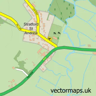
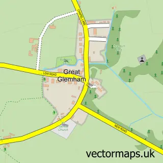
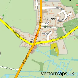
This Farnham street map is a detailed vector street map covering a 750m x 750m area. Select a larger area to create and download your own vector street map of Farnham.
The 750-metre map sample for Farnham covers 57 mapped buildings and approximately 7.6 km of road detail, of which 3 named roads are named. To create a larger or custom map of Farnham, the map builder lets you define your own coverage area and download editable SVG, PDF and PNG files.
Create a larger editable map of Farnham
Choose any area you need and generate a high-quality vector map instantly. Perfect for print, planning, design, business and personal use.

This Farnham street map in Suffolk is available as downloadable SVG, PDF and PNG map files, or as a printed map for planning, business, display, education, local information and design work. You can also create a larger custom map area using the map selector.
What this Farnham map sample shows
Farnham lies within Farnham Cp parish, part of Wickham Market ward in the East Suffolk District local authority area. The postcode geography for this area includes the IP postcode area, the IP17 postcode district and the IP17 1 postcode sector. Residents fall under the Nhs Suffolk And North East Essex Integrated Care Board for NHS services.
Administrative and postcode information for Farnham
The local authority covering Farnham is East Suffolk District, within the county of Suffolk. The settlement lies within Wickham Market ward and Farnham Cp civil parish. The IP17 postcode district and IP17 1 postcode sector serve the immediate area. NHS provision in the area is delivered through East Suffolk And North Essex Nhs Foundation Trust.
Nearby street map samples around Farnham

More street maps in Suffolk
750 metre map area coverage
Boundary, postcode and point of interest information for the 750m x 750m rectangle centred on this sample map.
Boundaries containing map centre
Constituency: Central Suffolk and North Ipswich Co Const
County: Suffolk County
District: East Suffolk District
Icb: NHS Essex ICB
Parish: Farnham CP
Police Force: suffolk
Postcode District: IP17
Postcode Sector: IP17 1
Ward: Wickham Market Ward
Nearby boundaries intersecting sample
Constituency: Suffolk Coastal Co Const
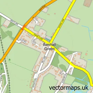
Parish: Benhall CP, Stratford St. Andrew CP
Ward: Aldeburgh & Leiston Ward
Postcode coverage
POI category counts
Community Center: 2
Anglican Church: 1
Building Supply Store: 1
Contractor: 1
Funeral Services And Cemeteries: 1
Furniture Assembly: 1
Furniture Store: 1
Home Improvement Store: 1
Music Venue: 1
Personal Care Service: 1
Sample points of interest
- Farnham & Stratford St Andrew, St Mary
- Greenfuture Solutions
- Riverside Centre
- Stratford St Andrew Riverside Centre
- Greenfuture Energy
- Valerie Leverett Memorials
- Anglia Upholstery
- Absolute Carpets
- Greenfuture Energy Ltd.
- Everyman Folk Club
- Garrick Flooring Centre Ltd.
- Farnham Leisure
Create a larger editable map of Farnham
This sample shows only a 750 metre area. To create a larger map of Farnham, use our map builder to choose your own coverage area, add titles and download editable SVG, PDF and PNG files.
Create a custom map of Farnham