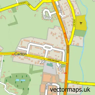
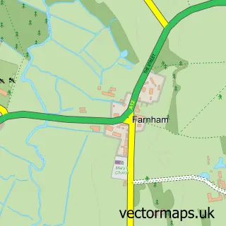
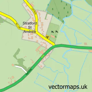
This Saxmundham street map is a detailed vector street map covering a 750m x 750m area. Select a larger area to create and download your own vector street map of Saxmundham.
The 750-metre map sample for Saxmundham covers 444 mapped buildings and approximately 14.6 km of road detail, of which 36 named roads are named. The immediate area includes 1 railway station, 1 GP surgery within 2 miles, 2 pubs and 2 MOT stations. The wider area around Saxmundham features 1 tourism point of interest, 10 food and drink venues and 1 hotel. To create a larger or custom map of Saxmundham, the map builder lets you define your own coverage area and download editable SVG, PDF and PNG files.
Create a larger editable map of Saxmundham
Choose any area you need and generate a high-quality vector map instantly. Perfect for print, planning, design, business and personal use.

This Saxmundham street map in Suffolk is available as downloadable SVG, PDF and PNG map files, or as a printed map for planning, business, display, education, local information and design work. You can also create a larger custom map area using the map selector.
What this Saxmundham map sample shows
Saxmundham lies within Saxmundham Cp parish, part of Saxmundham ward in the East Suffolk District local authority area. The postcode geography for this area includes the IP postcode area, the IP17 postcode district and the IP17 1 postcode sector. Residents fall under the Nhs Suffolk And North East Essex Integrated Care Board for NHS services.
Local features near Saxmundham
Within 2 milesAmenities and services in and around Saxmundham.
Administrative and postcode information for Saxmundham
Saxmundham lies within Saxmundham Cp parish, part of Saxmundham ward in the East Suffolk District local authority area. The postcode geography for this area includes the IP postcode area, the IP17 postcode district and the IP17 1 postcode sector. Residents fall under the Nhs Suffolk And North East Essex Integrated Care Board for NHS services.
Nearby street map samples around Saxmundham

More street maps in Suffolk
750 metre map area coverage
Boundary, postcode and point of interest information for the 750m x 750m rectangle centred on this sample map.
Boundaries containing map centre
Constituency: Suffolk Coastal Co Const
County: Suffolk County
District: East Suffolk District
Icb: NHS Essex ICB
Parish: Saxmundham CP
Police Force: suffolk
Postcode District: IP17
Postcode Sector: IP17 1
Ward: Saxmundham Ward
Nearby boundaries intersecting sample
No additional intersecting boundaries found.
Postcode coverage
POI category counts
Beauty Salon: 7
Professional Services: 6
Coffee Shop: 4
Hair Salon: 4
Real Estate Agent: 4
Bakery: 3
Bank Credit Union: 3
Cafe: 3
Furniture Store: 3
Parking: 3
Sample points of interest
- Apex Accounting
- St John the Baptist, Saxmundham
- St Elizabeth Hospice
- The Barn Co.
- The George Farnham Gallery
- Emma K Framing
- Katiecustard
- Grafo Products
- M.R. King & Sons
- Get Stuffed
- Number 1 Bakery
- The Chantry Kitchen
Create a larger editable map of Saxmundham
This sample shows only a 750 metre area. To create a larger map of Saxmundham, use our map builder to choose your own coverage area, add titles and download editable SVG, PDF and PNG files.
Create a custom map of Saxmundham