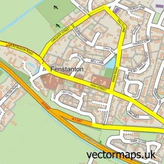
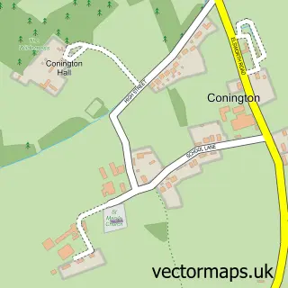
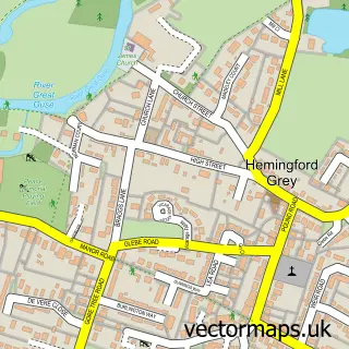
This Fen Drayton street map is a detailed vector street map covering a 750m x 750m area. Select a larger area to create and download your own vector street map of Fen Drayton.
The 750-metre map sample for Fen Drayton covers 256 mapped buildings and approximately 10.5 km of road detail, of which 13 named roads are named. The immediate area includes 1 school, 1 GP surgery within 2 miles, 1 pub and 3 MOT stations within 2 miles. The wider area around Fen Drayton features 1 tourism point of interest and 1 food and drink venue. To create a larger or custom map of Fen Drayton, the map builder lets you define your own coverage area and download editable SVG, PDF and PNG files.
Create a larger editable map of Fen Drayton
Choose any area you need and generate a high-quality vector map instantly. Perfect for print, planning, design, business and personal use.

This Fen Drayton street map in Cambridgeshire is available as downloadable SVG, PDF and PNG map files, or as a printed map for planning, business, display, education, local information and design work. You can also create a larger custom map area using the map selector.
What this Fen Drayton map sample shows
Fen Drayton lies within Fen Drayton Cp parish, part of Swavesey ward in the South Cambridgeshire District local authority area. The postcode geography for this area includes the CB postcode area, the CB24 postcode district and the CB24 4 postcode sector. Residents fall under the Nhs Cambridgeshire And Peterborough Integrated Care Board for NHS services.
Local features near Fen Drayton
Within 2 milesAmenities and services in and around Fen Drayton.
Administrative and postcode information for Fen Drayton
Fen Drayton lies within Fen Drayton Cp parish, part of Swavesey ward in the South Cambridgeshire District local authority area. The postcode geography for this area includes the CB postcode area, the CB24 postcode district and the CB24 4 postcode sector. Residents fall under the Nhs Cambridgeshire And Peterborough Integrated Care Board for NHS services.
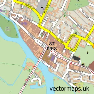
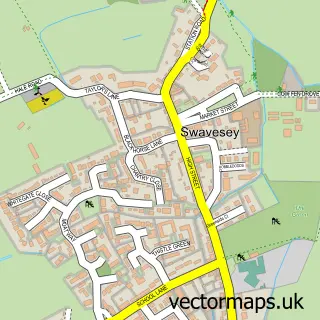
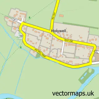
Nearby street map samples around Fen Drayton

More street maps in Cambridgeshire
750 metre map area coverage
Boundary, postcode and point of interest information for the 750m x 750m rectangle centred on this sample map.
Boundaries containing map centre
Constituency: St. Neots and Mid Cambridgeshire Co Const
County: Cambridgeshire County
District: South Cambridgeshire District
Icb: NHS Central East ICB
Parish: Fen Drayton CP
Police Force: cambridgeshire
Postcode District: CB24
Postcode Sector: CB24 4
Ward: Swavesey Ward
Nearby boundaries intersecting sample
No additional intersecting boundaries found.
Postcode coverage
POI category counts
Bed And Breakfast: 2
Business Management Services: 2
Home Service: 2
Anglican Church: 1
Arts And Entertainment: 1
Automotive Services And Repair: 1
Beauty Salon: 1
Car Dealer: 1
Caterer: 1
Community Center: 1
Sample points of interest
- Fen Drayton: St Mary the Virgin
- Paul Butterworth Actor
- Gardasoft
- Studio Novo
- Thorn House B&B
- Thorn House Bed & Breakfast
- Fen Drayton Montessori Nursery
- Sunhill Day Nursery Fen Drayton
- Car Advice Net
- Pig Out Catering
- Fen Drayton Village Hall
- Fen Drayton Primary School
Create a larger editable map of Fen Drayton
This sample shows only a 750 metre area. To create a larger map of Fen Drayton, use our map builder to choose your own coverage area, add titles and download editable SVG, PDF and PNG files.
Create a custom map of Fen Drayton