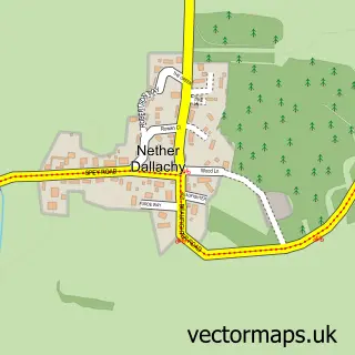
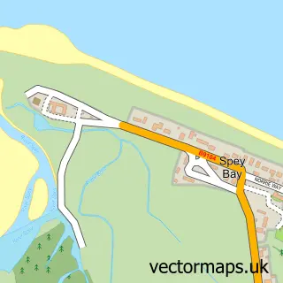
This Fochabers street map is a detailed vector street map covering a 750m x 750m area. Select a larger area to create and download your own vector street map of Fochabers.
The 750-metre map sample for Fochabers covers 303 mapped buildings and approximately 19.1 km of road detail, of which 22 named roads are named. The immediate area includes 1 GP surgery, 2 pubs and 1 MOT station within 2 miles. The wider area around Fochabers features 5 tourism points of interest, 5 food and drink venues and 3 hotels. To create a larger or custom map of Fochabers, the map builder lets you define your own coverage area and download editable SVG, PDF and PNG files.
Create a larger editable map of Fochabers
Choose any area you need and generate a high-quality vector map instantly. Perfect for print, planning, design, business and personal use.

This Fochabers street map in Moray is available as downloadable SVG, PDF and PNG map files, or as a printed map for planning, business, display, education, local information and design work. You can also create a larger custom map area using the map selector.
What this Fochabers map sample shows
Fochabers lies within Moray parish, part of Fochabers Lhanbryde ward in the Moray local authority area. The postcode geography for this area includes the IV postcode area, the IV32 postcode district and the IV32 7 postcode sector. Residents fall under the Grampian for NHS services.
Local features near Fochabers
Within 2 milesAmenities and services in and around Fochabers.
Administrative and postcode information for Fochabers
Fochabers lies within Moray parish, part of Fochabers Lhanbryde ward in the Moray local authority area. The postcode geography for this area includes the IV postcode area, the IV32 postcode district and the IV32 7 postcode sector. Residents fall under the Grampian for NHS services.
Nearby street map samples around Fochabers

More street maps in Moray
750 metre map area coverage
Boundary, postcode and point of interest information for the 750m x 750m rectangle centred on this sample map.
Boundaries containing map centre
Constituency: Aberdeenshire North and Moray East Co Const
District: Moray
Icb: Grampian
Postcode District: IV32
Postcode Sector: IV32 7
Ward: Fochabers Lhanbryde Ward
Nearby boundaries intersecting sample
No additional intersecting boundaries found.
Postcode coverage
POI category counts
Beauty Salon: 4
Barber: 3
Church Cathedral: 3
Doctor: 3
Hotel: 3
Museum: 3
Antique Store: 2
Business Management Services: 2
Cafe: 2
Community Services Non Profits: 2
Sample points of interest
- Gordon Castle Fishings
- Art & Antiques
- Watt's Antiques
- Alanda Streames Portraits Etc
- The Cooperative Food Fochabers, High Street
- Swg valeting
- Moar Web Designs
- Classic Cakes
- Bank of Scotland
- The Arc Sessions
- Barbers
- Fochabers Barbers
Create a larger editable map of Fochabers
This sample shows only a 750 metre area. To create a larger map of Fochabers, use our map builder to choose your own coverage area, add titles and download editable SVG, PDF and PNG files.
Create a custom map of Fochabers