Vector Maps logo
Home Why it works Popular maps Districts Samples Customizer Create Your Map
VectorMaps.uk
Home Popular maps Districts Samples Customizer Create Your Map Privacy Disclaimer
Home / UK Maps / Kincardineshire / Fordoun Map

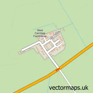
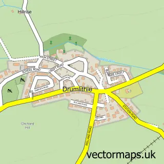
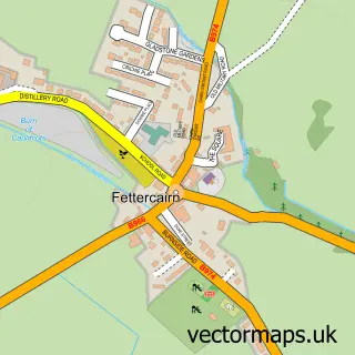
This Fordoun street map is a detailed vector street map covering a 750m x 750m area. Select a larger area to create and download your own vector street map of Fordoun.

Fordoun is a village in Kincardineshire, in the North East Scotland of Scotland. The settlement falls within the West Aberdeenshire And Kincardine parliamentary constituency. It is served by the AB30 postcode district, with AB30 1 as the local postcode se

The 750-metre map sample for Fordoun covers 85 mapped buildings and approximately 10.5 km of road detail, of which 8 named roads are named. The wider area around Fordoun features 1 tourism point of interest and 1 hotel. To create a larger or custom map of Fordoun, the map builder lets you define your own coverage area and download editable SVG, PDF and PNG files.

85Buildings
10.54 kmRoads
8Named roads
0Residents within 2 miles
Create your own

Create a larger editable map of Fordoun

Choose any area you need and generate a high-quality vector map instantly. Perfect for print, planning, design, business and personal use.

Choose any location
Editable SVG files
Any size up to A0
PDF, PNG & more
Instant download
High quality guaranteed
Create My Custom Map
Secure, private & no credit card required
Fordoun Vector Street Map
750m Sample
Fordoun vector street map sample showing roads, buildings and local features in a 750 metre preview area
Buy Fordoun Map Print from £12.95 Buy Fordoun Digital Map from £6

This Fordoun street map in Kincardineshire is available as downloadable SVG, PDF and PNG map files, or as a printed map for planning, business, display, education, local information and design work. You can also create a larger custom map area using the map selector.

What this Fordoun map sample shows

Fordoun lies within Aberdeenshire parish, part of Mearns ward in the Aberdeenshire local authority area. The postcode geography for this area includes the AB postcode area, the AB30 postcode district and the AB30 1 postcode sector. Residents fall under the Grampian for NHS services.

Local features near Fordoun

Within 2 miles

Amenities and services in and around Fordoun.

1 Tourism & leisure
1 Hotels
2 Vehicle services

Counts are approximate and based on publicly available data.

Administrative and postcode information for Fordoun

Fordoun lies within Aberdeenshire parish, part of Mearns ward in the Aberdeenshire local authority area. The postcode geography for this area includes the AB postcode area, the AB30 postcode district and the AB30 1 postcode sector. Residents fall under the Grampian for NHS services.

Parish ABERDEENSHIRE
Ward Mearns
District / local authority Aberdeenshire
County Kincardineshire
Historic county Kincardineshire
Postcode district AB30
Postcode sector AB30 1
Parliamentary constituency West Aberdeenshire and Kincardine
Region North East Scotland
Country Scotland

Nearby street map samples around Fordoun

Street map sample of Laurencekirk, Kincardineshire Laurencekirk Town - Kincardineshire - 3.5 miles Street map sample of Aberdeen, City of Aberdeen Aberdeen City - City of Aberdeen - 22.5 miles Street map sample of Auchenblae, Kincardineshire Auchenblae Village - Kincardineshire - 2.2 miles Street map sample of West Cairnbeg, Kincardineshire West Cairnbeg Village - Kincardineshire - 3.0 miles Street map sample of Arbuthnott, Kincardineshire Arbuthnott Village - Kincardineshire - 3.1 miles Street map sample of Drumlithie, Kincardineshire Drumlithie Village - Kincardineshire - 3.9 miles Street map sample of Gourdon, Kincardineshire Gourdon Village - Kincardineshire - 5.6 miles Street map sample of Roadside of Kinneff, Kincardineshire Roadside of Kinneff Village - Kincardineshire - 5.9 miles Street map sample of Johnshaven, Kincardineshire Johnshaven Village - Kincardineshire - 6.2 miles Street map sample of Fettercairn, Kincardineshire Fettercairn Village - Kincardineshire - 6.3 miles

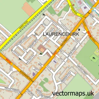
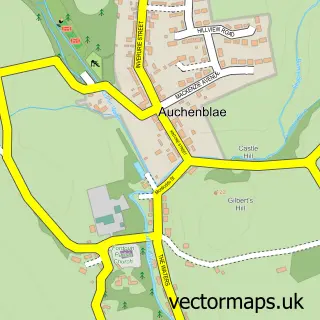
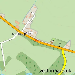
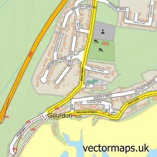
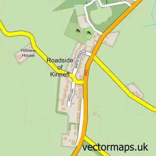
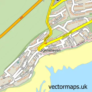
More street maps in Kincardineshire

Street map sample of Auchenblae, Kincardineshire Auchenblae Village - 2.2 miles Street map sample of West Cairnbeg, Kincardineshire West Cairnbeg Village - 3.0 miles Street map sample of Arbuthnott, Kincardineshire Arbuthnott Village - 3.1 miles Street map sample of Laurencekirk, Kincardineshire Laurencekirk Town - 3.5 miles Street map sample of Drumlithie, Kincardineshire Drumlithie Village - 3.9 miles

750 metre map area coverage

Boundary, postcode and point of interest information for the 750m x 750m rectangle centred on this sample map.

Boundaries containing map centre

Constituency: West Aberdeenshire and Kincardine Co Const

District: Aberdeenshire

Icb: Grampian

Postcode District: AB30

Postcode Sector: AB30 1

Ward: Mearns Ward

Nearby boundaries intersecting sample

No additional intersecting boundaries found.

Postcode coverage

AB30 AB30 1

POI category counts

Automotive Repair: 2

Post Office: 2

Auto Body Shop: 1

Business Signage: 1

Event Planning: 1

Financial Service: 1

Fire Department: 1

Hotel: 1

Jewelry Store: 1

Park: 1

Sample points of interest

  • Barry Cooper Automotives Auto Body Shop
  • Alba Auto Tech Automotive Repair
  • Stuart Cooper Motors ltd Automotive Repair
  • BlackW Sign Shop Business Signage
  • Fordoun Village Hall Event Planning
  • Henderson Bookkeeping Financial Service
  • Laurencekirk Community Fire Station Fire Department
  • The Redhall Arms Hotel Hotel
  • Simply Stylish Silver Jewelry Store
  • Hampden Park Glasgow Park
  • Bowman Productions Photographer
  • DPC Heating and Plumbing Plumbing

Create a larger editable map of Fordoun

This sample shows only a 750 metre area. To create a larger map of Fordoun, use our map builder to choose your own coverage area, add titles and download editable SVG, PDF and PNG files.

Create a custom map of Fordoun

Phone 01751 473136 | Copyright Vectormaps.uk 2026

Samples Customizer Privacy Disclaimer
Fordoun Vector Street Map
Fordoun enlarged street map sample showing a 750 metre preview area