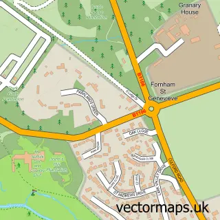
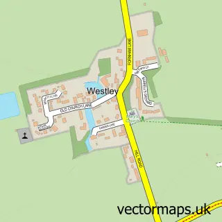
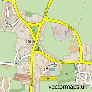
This Fornham All Saints street map is a detailed vector street map covering a 750m x 750m area. Select a larger area to create and download your own vector street map of Fornham All Saints.
The 750-metre map sample for Fornham All Saints covers 201 mapped buildings and approximately 11.6 km of road detail, of which 10 named roads are named. The immediate area includes 1 GP surgery within 2 miles, 3 pubs and 14 MOT stations within 2 miles. The wider area around Fornham All Saints features 1 tourism point of interest and 5 food and drink venues. To create a larger or custom map of Fornham All Saints, the map builder lets you define your own coverage area and download editable SVG, PDF and PNG files.
Create a larger editable map of Fornham All Saints
Choose any area you need and generate a high-quality vector map instantly. Perfect for print, planning, design, business and personal use.

This Fornham All Saints street map in Suffolk is available as downloadable SVG, PDF and PNG map files, or as a printed map for planning, business, display, education, local information and design work. You can also create a larger custom map area using the map selector.
What this Fornham All Saints map sample shows
Fornham All Saints lies within Fornham All Saints Cp parish, part of The Fornhams & Great Barton ward in the West Suffolk District local authority area. The postcode geography for this area includes the IP postcode area, the IP28 postcode district and the IP28 6 postcode sector. Residents fall under the Nhs Suffolk And North East Essex Integrated Care Board for NHS services.
Local features near Fornham All Saints
Within 2 milesAmenities and services in and around Fornham All Saints.
Administrative and postcode information for Fornham All Saints
Fornham All Saints lies within Fornham All Saints Cp parish, part of The Fornhams & Great Barton ward in the West Suffolk District local authority area. The postcode geography for this area includes the IP postcode area, the IP28 postcode district and the IP28 6 postcode sector. Residents fall under the Nhs Suffolk And North East Essex Integrated Care Board for NHS services.
Nearby street map samples around Fornham All Saints
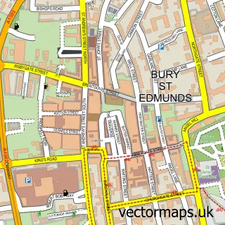

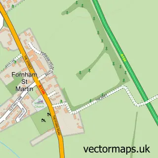
More street maps in Suffolk
750 metre map area coverage
Boundary, postcode and point of interest information for the 750m x 750m rectangle centred on this sample map.
Boundaries containing map centre
Constituency: Bury St. Edmunds and Stowmarket Co Const
County: Suffolk County
District: West Suffolk District
Icb: NHS Essex ICB
Parish: Fornham All Saints CP
Police Force: suffolk
Postcode District: IP28
Postcode Sector: IP28 6
Ward: The Fornhams & Great Barton Ward
Nearby boundaries intersecting sample
No additional intersecting boundaries found.
Postcode coverage
POI category counts
Accountant: 5
Pub: 3
Church Cathedral: 2
Anglican Church: 1
Banks: 1
Building Supply Store: 1
Business Management Services: 1
Cafe: 1
Coffee Shop: 1
Community Center: 1
Sample points of interest
- Demoore Accountancy Services
- Ensors Chartered Accountants
- Gascoynes
- Gascoynes Chartered Accountants
- Westax
- Fornham, All Saints
- Clydesdale Bank Ifs
- Vale Interiors
- Hayden's Arboricultural Consultants
- The Organic Restaurant
- All Saints Church
- Fornham All Saints Church
Create a larger editable map of Fornham All Saints
This sample shows only a 750 metre area. To create a larger map of Fornham All Saints, use our map builder to choose your own coverage area, add titles and download editable SVG, PDF and PNG files.
Create a custom map of Fornham All Saints