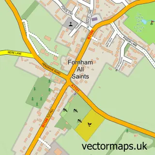
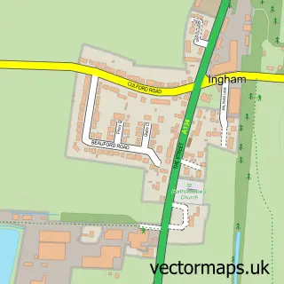
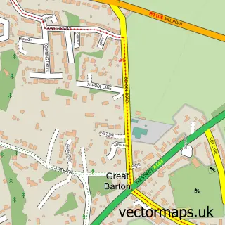
This Fornham St Genevieve street map is a detailed vector street map covering a 750m x 750m area. Select a larger area to create and download your own vector street map of Fornham St Genevieve.
The 750-metre map sample for Fornham St Genevieve covers 211 mapped buildings and approximately 8.7 km of road detail, of which 12 named roads are named. The immediate area includes 15 MOT stations within 2 miles. The wider area around Fornham St Genevieve features 1 tourism point of interest, 1 food and drink venue and 1 hotel. To create a larger or custom map of Fornham St Genevieve, the map builder lets you define your own coverage area and download editable SVG, PDF and PNG files.
Create a larger editable map of Fornham St Genevieve
Choose any area you need and generate a high-quality vector map instantly. Perfect for print, planning, design, business and personal use.

This Fornham St Genevieve street map in Suffolk is available as downloadable SVG, PDF and PNG map files, or as a printed map for planning, business, display, education, local information and design work. You can also create a larger custom map area using the map selector.
What this Fornham St Genevieve map sample shows
Fornham St Genevieve lies within Fornham St. Martin Cp parish, part of The Fornhams & Great Barton ward in the West Suffolk District local authority area. The postcode geography for this area includes the IP postcode area, the IP28 postcode district and the IP28 6 postcode sector. Residents fall under the Nhs Suffolk And North East Essex Integrated Care Board for NHS services.
Local features near Fornham St Genevieve
Within 2 milesAmenities and services in and around Fornham St Genevieve.
Administrative and postcode information for Fornham St Genevieve
Fornham St Genevieve lies within Fornham St. Martin Cp parish, part of The Fornhams & Great Barton ward in the West Suffolk District local authority area. The postcode geography for this area includes the IP postcode area, the IP28 postcode district and the IP28 6 postcode sector. Residents fall under the Nhs Suffolk And North East Essex Integrated Care Board for NHS services.
Nearby street map samples around Fornham St Genevieve

More street maps in Suffolk
750 metre map area coverage
Boundary, postcode and point of interest information for the 750m x 750m rectangle centred on this sample map.
Boundaries containing map centre
Constituency: Bury St. Edmunds and Stowmarket Co Const
County: Suffolk County
District: West Suffolk District
Icb: NHS Essex ICB
Parish: Fornham St. Genevieve CP
Police Force: suffolk
Postcode District: IP28
Postcode Sector: IP28 6
Ward: The Fornhams & Great Barton Ward
Nearby boundaries intersecting sample
Parish: Fornham All Saints CP, Fornham St. Martin CP
Postcode coverage
POI category counts
Business Management Services: 2
Charity Organization: 2
Naturopathic Holistic: 2
Professional Services: 2
Spas: 2
Accommodation: 1
Acupuncture: 1
Advertising Agency: 1
Architectural Designer: 1
Beauty Salon: 1
Sample points of interest
- All Saints Resort
- Abbey Acupuncture
- V T M
- Maude and Edwards Architects
- elemis
- C & C Training Ltd.
- CS Certs
- Suffolk West Federation of WIs
- Suffolk West Federation of Womens Institutes
- Fornham St Genevieve
- Oak Tree Management and Training
- Karen Curdy
Create a larger editable map of Fornham St Genevieve
This sample shows only a 750 metre area. To create a larger map of Fornham St Genevieve, use our map builder to choose your own coverage area, add titles and download editable SVG, PDF and PNG files.
Create a custom map of Fornham St Genevieve