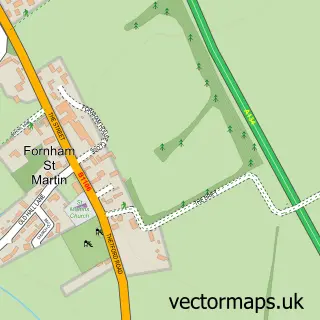
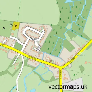
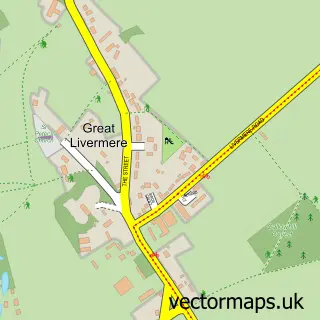
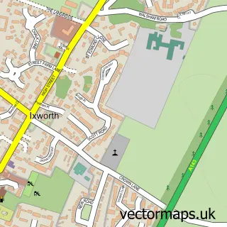
This Great Barton street map is a detailed vector street map covering a 750m x 750m area. Select a larger area to create and download your own vector street map of Great Barton.
The 750-metre map sample for Great Barton covers 300 mapped buildings and approximately 12.4 km of road detail, of which 18 named roads are named. The immediate area includes 1 school and 3 MOT stations within 2 miles. The wider area around Great Barton features 2 food and drink venues. To create a larger or custom map of Great Barton, the map builder lets you define your own coverage area and download editable SVG, PDF and PNG files.
Create a larger editable map of Great Barton
Choose any area you need and generate a high-quality vector map instantly. Perfect for print, planning, design, business and personal use.

This Great Barton street map in Suffolk is available as downloadable SVG, PDF and PNG map files, or as a printed map for planning, business, display, education, local information and design work. You can also create a larger custom map area using the map selector.
What this Great Barton map sample shows
Great Barton lies within Great Barton Cp parish, part of The Fornhams & Great Barton ward in the West Suffolk District local authority area. The postcode geography for this area includes the IP postcode area, the IP31 postcode district and the IP31 2 postcode sector. Residents fall under the Nhs Suffolk And North East Essex Integrated Care Board for NHS services.
Local features near Great Barton
Within 2 milesAmenities and services in and around Great Barton.
Administrative and postcode information for Great Barton
The local authority covering Great Barton is West Suffolk District, within the county of Suffolk. The settlement lies within The Fornhams & Great Barton ward and Great Barton Cp civil parish. The IP31 postcode district and IP31 2 postcode sector serve the immediate area. NHS provision in the area is delivered through West Suffolk Nhs Foundation Trust.
Nearby street map samples around Great Barton
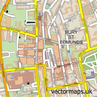

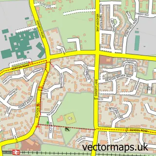
More street maps in Suffolk
750 metre map area coverage
Boundary, postcode and point of interest information for the 750m x 750m rectangle centred on this sample map.
Boundaries containing map centre
Constituency: Bury St. Edmunds and Stowmarket Co Const
County: Suffolk County
District: West Suffolk District
Icb: NHS Essex ICB
Parish: Great Barton CP
Police Force: suffolk
Postcode District: IP31
Postcode Sector: IP31 2
Ward: The Fornhams & Great Barton Ward
Nearby boundaries intersecting sample
No additional intersecting boundaries found.
Postcode coverage
POI category counts
Gas Station: 4
Books Mags Music And Video: 2
Beauty Salon: 1
Building Supply Store: 1
Bus Service: 1
Cafe: 1
Coffee Shop: 1
Community Center: 1
Convenience Store: 1
Currency Exchange: 1
Sample points of interest
- Head2Soul
- Great Barton Post Office
- Post Office-Great Barton
- Thorough Fencing & Landscaping
- Turners of Great Barton
- Freedom Tots Cafe Toddler Group
- Costa Express
- Great Barton Village Hall
- Hursts
- Post Office Travel Money
- Great Barton CEVC Primary School
- Oakampton House
Create a larger editable map of Great Barton
This sample shows only a 750 metre area. To create a larger map of Great Barton, use our map builder to choose your own coverage area, add titles and download editable SVG, PDF and PNG files.
Create a custom map of Great Barton