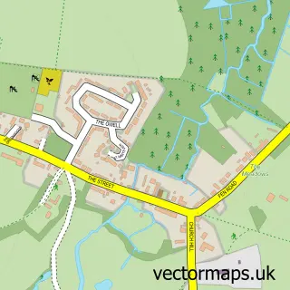
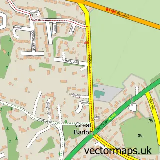
This Thurston street map is a detailed vector street map covering a 750m x 750m area. Select a larger area to create and download your own vector street map of Thurston.
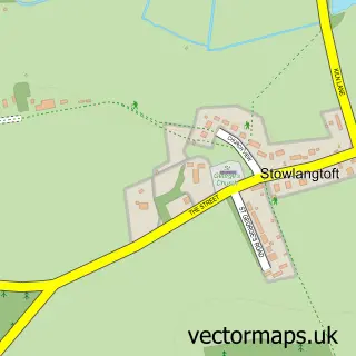
The 750-metre map sample for Thurston covers 583 mapped buildings and approximately 13.7 km of road detail, of which 28 named roads are named. The immediate area includes 1 school, 1 railway station, 1 pub and 2 MOT stations, with 5 within 2 miles. The wider area around Thurston features 5 food and drink venues. To create a larger or custom map of Thurston, the map builder lets you define your own coverage area and download editable SVG, PDF and PNG files.
Create a larger editable map of Thurston
Choose any area you need and generate a high-quality vector map instantly. Perfect for print, planning, design, business and personal use.

This Thurston street map in Suffolk is available as downloadable SVG, PDF and PNG map files, or as a printed map for planning, business, display, education, local information and design work. You can also create a larger custom map area using the map selector.
What this Thurston map sample shows
Thurston lies within Thurston Cp parish, part of Thurston ward in the Mid Suffolk District local authority area. The postcode geography for this area includes the IP postcode area, the IP31 postcode district and the IP31 3 postcode sector. Residents fall under the Nhs Suffolk And North East Essex Integrated Care Board for NHS services.
Local features near Thurston
Within 2 milesAmenities and services in and around Thurston.
Administrative and postcode information for Thurston
The local authority covering Thurston is Mid Suffolk District, within the county of Suffolk. The settlement lies within Thurston ward and Thurston Cp civil parish. The IP31 postcode district and IP31 3 postcode sector serve the immediate area. NHS provision in the area is delivered through West Suffolk Nhs Foundation Trust.
Nearby street map samples around Thurston

More street maps in Suffolk
750 metre map area coverage
Boundary, postcode and point of interest information for the 750m x 750m rectangle centred on this sample map.
Boundaries containing map centre
Constituency: Bury St. Edmunds and Stowmarket Co Const
County: Suffolk County
District: Mid Suffolk District
Icb: NHS Essex ICB
Parish: Thurston CP
Police Force: suffolk
Postcode District: IP31
Postcode Sector: IP31 3
Ward: Thurston Ward
Nearby boundaries intersecting sample
Postcode District: IP30
Postcode Sector: IP30 9
Postcode coverage
POI category counts
Coffee Shop: 4
Automotive Repair: 3
Train Station: 3
Accountant: 1
Arts And Entertainment: 1
Automotive Parts And Accessories: 1
Barber: 1
Beauty Salon: 1
Carpet Cleaning: 1
Child Care And Day Care: 1
Sample points of interest
- Abbeygate Accountancy
- Cars on the Green
- Abbey Motor Factors
- B Starie
- David Martin Motor Engineers
- Diesel Care
- Dapper Dean's Barber Shop
- The Hair & Beauty Studio
- Rothwell's Cleaning Services Ltd.
- Wood N Stuff
- Costa Express
- Rossa Coffee Shop
Create a larger editable map of Thurston
This sample shows only a 750 metre area. To create a larger map of Thurston, use our map builder to choose your own coverage area, add titles and download editable SVG, PDF and PNG files.
Create a custom map of Thurston