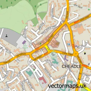
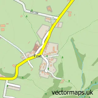
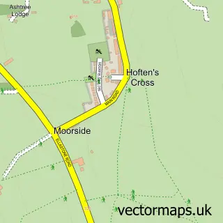
This Froghall street map is a detailed vector street map covering a 750m x 750m area. Select a larger area to create and download your own vector street map of Froghall.
The 750-metre map sample for Froghall covers 100 mapped buildings and approximately 12.5 km of road detail, of which 6 named roads are named. The immediate area includes 1 railway station. The wider area around Froghall features 1 tourism point of interest and 1 hotel. To create a larger or custom map of Froghall, the map builder lets you define your own coverage area and download editable SVG, PDF and PNG files.
Create a larger editable map of Froghall
Choose any area you need and generate a high-quality vector map instantly. Perfect for print, planning, design, business and personal use.

This Froghall street map in Staffordshire is available as downloadable SVG, PDF and PNG map files, or as a printed map for planning, business, display, education, local information and design work. You can also create a larger custom map area using the map selector.
What this Froghall map sample shows
Froghall lies within Kingsley Cp parish, part of Churnet ward in the Staffordshire Moorlands District local authority area. The postcode geography for this area includes the ST postcode area, the ST10 postcode district and the ST10 2 postcode sector. Residents fall under the Nhs Staffordshire And Stoke-On-Trent Integrated Care Board for NHS services.
Local features near Froghall
Within 2 milesAmenities and services in and around Froghall.
Administrative and postcode information for Froghall
Froghall lies within Kingsley Cp parish, part of Churnet ward in the Staffordshire Moorlands District local authority area. The postcode geography for this area includes the ST postcode area, the ST10 postcode district and the ST10 2 postcode sector. Residents fall under the Nhs Staffordshire And Stoke-On-Trent Integrated Care Board for NHS services.
Nearby street map samples around Froghall

More street maps in Staffordshire
750 metre map area coverage
Boundary, postcode and point of interest information for the 750m x 750m rectangle centred on this sample map.
Boundaries containing map centre
Constituency: Staffordshire Moorlands Co Const
County: Staffordshire County
District: Staffordshire Moorlands District
Icb: NHS Staffordshire and Stoke-on-Trent ICB
Parish: Kingsley CP
Police Force: staffordshire
Postcode District: ST10
Postcode Sector: ST10 2
Ward: Churnet Ward
Nearby boundaries intersecting sample
Parish: Ipstones CP
Ward: Ipstones Ward
Postcode coverage
POI category counts
Train Station: 2
Auto Parts And Supply Store: 1
Automotive Parts And Accessories: 1
Automotive Repair: 1
Hotel: 1
Landmark And Historical Building: 1
Marketing Agency: 1
Rental Service: 1
Resort: 1
Retail: 1
Sample points of interest
- Cartakeback
- Autoline Motors Ltd
- Autoline Motors
- The Railway Inn (Froghall)
- Froghall
- Sniper Marketing
- W J Jordan and Sons
- The Railway Inn (Froghall)
- Trend Retail Solutions
- Agility DGS Stoke
- Churnet Valley Railway
- Kingsley and Froghall railway station
Create a larger editable map of Froghall
This sample shows only a 750 metre area. To create a larger map of Froghall, use our map builder to choose your own coverage area, add titles and download editable SVG, PDF and PNG files.
Create a custom map of Froghall