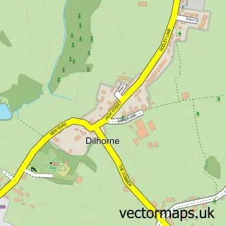
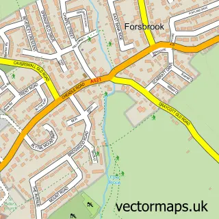
This Cheadle street map is a detailed vector street map covering a 750m x 750m area. Select a larger area to create and download your own vector street map of Cheadle.
The 750-metre map sample for Cheadle covers 428 mapped buildings and approximately 25.0 km of road detail, of which 42 named roads are named. The immediate area includes 4 schools, 1 GP surgery, with 3 within 2 miles, 7 pubs and 1 MOT station, with 5 within 2 miles. The wider area around Cheadle features 1 tourism point of interest, 16 food and drink venues and 2 hotels. To create a larger or custom map of Cheadle, the map builder lets you define your own coverage area and download editable SVG, PDF and PNG files.
Create a larger editable map of Cheadle
Choose any area you need and generate a high-quality vector map instantly. Perfect for print, planning, design, business and personal use.

This Cheadle street map in Staffordshire is available as downloadable SVG, PDF and PNG map files, or as a printed map for planning, business, display, education, local information and design work. You can also create a larger custom map area using the map selector.
What this Cheadle map sample shows
Cheadle lies within Cheadle Cp parish, part of Cheadle West ward in the Staffordshire Moorlands District local authority area. The postcode geography for this area includes the ST postcode area, the ST10 postcode district and the ST10 1 postcode sector. Residents fall under the Nhs Staffordshire And Stoke-On-Trent Integrated Care Board for NHS services.
Local features near Cheadle
Within 2 milesAmenities and services in and around Cheadle.
Administrative and postcode information for Cheadle
The local authority covering Cheadle is Staffordshire Moorlands District, within the county of Staffordshire. The settlement lies within Cheadle West ward and Cheadle Cp civil parish. The ST10 postcode district and ST10 1 postcode sector serve the immediate area. NHS provision in the area is delivered through University Hospitals Of North Midlands Nhs Trust.
Nearby street map samples around Cheadle

More street maps in Staffordshire
750 metre map area coverage
Boundary, postcode and point of interest information for the 750m x 750m rectangle centred on this sample map.
Boundaries containing map centre
Constituency: Staffordshire Moorlands Co Const
County: Staffordshire County
District: Staffordshire Moorlands District
Icb: NHS Staffordshire and Stoke-on-Trent ICB
Parish: Cheadle CP
Police Force: staffordshire
Postcode District: ST10
Postcode Sector: ST10 1
Ward: Cheadle West Ward
Nearby boundaries intersecting sample
Ward: Cheadle North East Ward, Cheadle South East Ward
Postcode coverage
POI category counts
Beauty Salon: 16
Hair Salon: 7
Pub: 7
Automotive Repair: 6
Banks: 6
Church Cathedral: 6
Contractor: 6
Pizza Restaurant: 6
Tattoo And Piercing: 6
Beauty And Spa: 5
Sample points of interest
- DTJ Accountancy
- The Curtis Partnership
- Moorlands Equestrian Centre Ltd
- Samtara Holistics
- Victory Roll Vintage & Antiques
- T & G Electrics
- iQuatics
- Hewitt and Carr Architects
- Hewitt and Carr Services
- Powell Design & Construction
- Cheadle Cards
- Crafty Urchins
Create a larger editable map of Cheadle
This sample shows only a 750 metre area. To create a larger map of Cheadle, use our map builder to choose your own coverage area, add titles and download editable SVG, PDF and PNG files.
Create a custom map of Cheadle