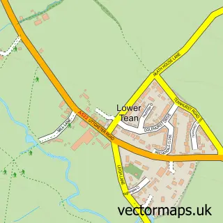
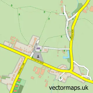
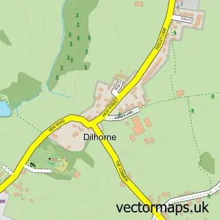
This Upper Tean street map is a detailed vector street map covering a 750m x 750m area. Select a larger area to create and download your own vector street map of Upper Tean.
The 750-metre map sample for Upper Tean covers 379 mapped buildings and approximately 18.1 km of road detail, of which 26 named roads are named. The immediate area includes 1 school, 1 GP surgery, with 2 within 2 miles, 1 pub and 4 MOT stations within 2 miles. The wider area around Upper Tean features 2 food and drink venues, 1 hotel and 1 campsite within 2 miles. To create a larger or custom map of Upper Tean, the map builder lets you define your own coverage area and download editable SVG, PDF and PNG files.
Create a larger editable map of Upper Tean
Choose any area you need and generate a high-quality vector map instantly. Perfect for print, planning, design, business and personal use.

This Upper Tean street map in Staffordshire is available as downloadable SVG, PDF and PNG map files, or as a printed map for planning, business, display, education, local information and design work. You can also create a larger custom map area using the map selector.
What this Upper Tean map sample shows
Upper Tean lies within Checkley Cp parish, part of Checkley ward in the Staffordshire Moorlands District local authority area. The postcode geography for this area includes the ST postcode area, the ST10 postcode district and the ST10 4 postcode sector. Residents fall under the Nhs Staffordshire And Stoke-On-Trent Integrated Care Board for NHS services.
Local features near Upper Tean
Within 2 milesAmenities and services in and around Upper Tean.
Administrative and postcode information for Upper Tean
The local authority covering Upper Tean is Staffordshire Moorlands District, within the county of Staffordshire. The settlement lies within Checkley ward and Checkley Cp civil parish. The ST10 postcode district and ST10 4 postcode sector serve the immediate area. NHS provision in the area is delivered through University Hospitals Of North Midlands Nhs Trust.
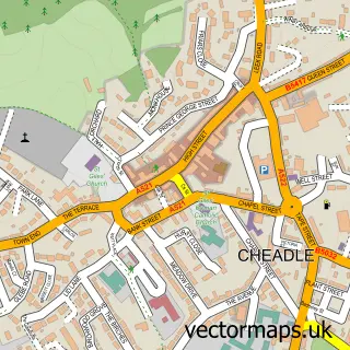
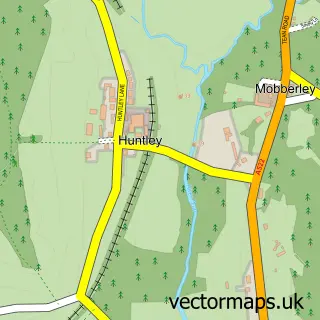
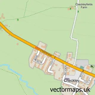
Nearby street map samples around Upper Tean

More street maps in Staffordshire
750 metre map area coverage
Boundary, postcode and point of interest information for the 750m x 750m rectangle centred on this sample map.
Boundaries containing map centre
Constituency: Stoke-on-Trent South Co Const
County: Staffordshire County
District: Staffordshire Moorlands District
Icb: NHS Staffordshire and Stoke-on-Trent ICB
Parish: Checkley CP
Police Force: staffordshire
Postcode District: ST10
Postcode Sector: ST10 4
Ward: Checkley Ward
Nearby boundaries intersecting sample
Parish: Draycott in the Moors CP
Postcode coverage
POI category counts
Contractor: 3
Bar: 2
Books Mags Music And Video: 2
Building Supply Store: 2
Doctor: 2
Elementary School: 2
Flowers And Gifts Shop: 2
Funeral Services And Cemeteries: 2
Hair Salon: 2
Landscaping: 2
Sample points of interest
- Smytheman Architectural
- Millstone Art & Antiques
- Big Top Music
- The Cooperative Food Tean, High Street
- The Crosskeys information page
- The Ship
- Moorlands Beauty
- Post Office-Tean
- Tean Post Office
- Compliance Principles Ltd
- Livearth
- Hygge Tean Coffee Shop
Create a larger editable map of Upper Tean
This sample shows only a 750 metre area. To create a larger map of Upper Tean, use our map builder to choose your own coverage area, add titles and download editable SVG, PDF and PNG files.
Create a custom map of Upper Tean