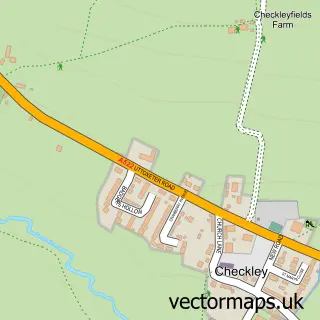
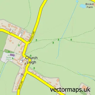
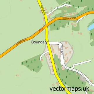
This Lower Tean street map is a detailed vector street map covering a 750m x 750m area. Select a larger area to create and download your own vector street map of Lower Tean.
The 750-metre map sample for Lower Tean covers 159 mapped buildings and approximately 13.8 km of road detail, of which 10 named roads are named. The immediate area includes 1 GP surgery within 2 miles, 1 pub and 1 MOT station within 2 miles. The wider area around Lower Tean features 1 food and drink venue and 1 campsite within 2 miles. To create a larger or custom map of Lower Tean, the map builder lets you define your own coverage area and download editable SVG, PDF and PNG files.
Create a larger editable map of Lower Tean
Choose any area you need and generate a high-quality vector map instantly. Perfect for print, planning, design, business and personal use.

This Lower Tean street map in Staffordshire is available as downloadable SVG, PDF and PNG map files, or as a printed map for planning, business, display, education, local information and design work. You can also create a larger custom map area using the map selector.
What this Lower Tean map sample shows
Lower Tean lies within Checkley Cp parish, part of Checkley ward in the Staffordshire Moorlands District local authority area. The postcode geography for this area includes the ST postcode area, the ST10 postcode district and the ST10 4 postcode sector. Residents fall under the Nhs Staffordshire And Stoke-On-Trent Integrated Care Board for NHS services.
Local features near Lower Tean
Within 2 milesAmenities and services in and around Lower Tean.
Administrative and postcode information for Lower Tean
Lower Tean lies within Checkley Cp parish, part of Checkley ward in the Staffordshire Moorlands District local authority area. The postcode geography for this area includes the ST postcode area, the ST10 postcode district and the ST10 4 postcode sector. Residents fall under the Nhs Staffordshire And Stoke-On-Trent Integrated Care Board for NHS services.
Nearby street map samples around Lower Tean

More street maps in Staffordshire
750 metre map area coverage
Boundary, postcode and point of interest information for the 750m x 750m rectangle centred on this sample map.
Boundaries containing map centre
Constituency: Stoke-on-Trent South Co Const
County: Staffordshire County
District: Staffordshire Moorlands District
Icb: NHS Staffordshire and Stoke-on-Trent ICB
Parish: Checkley CP
Police Force: staffordshire
Postcode District: ST10
Postcode Sector: ST10 4
Ward: Checkley Ward
Nearby boundaries intersecting sample
No additional intersecting boundaries found.
Postcode coverage
POI category counts
Freight And Cargo Service: 2
Pest Control Service: 2
Automotive Repair: 1
Beauty Product Supplier: 1
Business: 1
Car Dealer: 1
Contractor: 1
Furniture Store: 1
Gastropub: 1
Photographer: 1
Sample points of interest
- OS Fleet Care
- The Soapy Cauldron
- UK Operational Project Support
- WOM Automotive Limited
- Allsop Construction
- CPS Logistics
- Interlink Express Parcels
- Goviers of Sidmouth
- Dog & Partridge
- Cedar Pest Management
- Cedar Pest Management
- KLJ Photographic
Create a larger editable map of Lower Tean
This sample shows only a 750 metre area. To create a larger map of Lower Tean, use our map builder to choose your own coverage area, add titles and download editable SVG, PDF and PNG files.
Create a custom map of Lower Tean