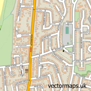
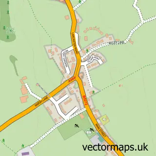
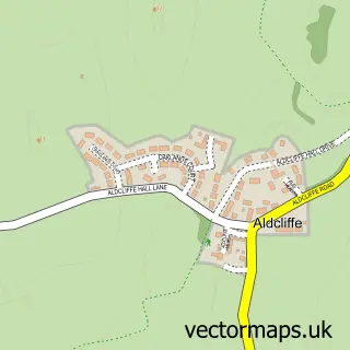
This Galgate street map is a detailed vector street map covering a 750m x 750m area. Select a larger area to create and download your own vector street map of Galgate.
The 750-metre map sample for Galgate covers 260 mapped buildings and approximately 11.0 km of road detail, of which 24 named roads are named. The immediate area includes 1 school, 1 pub and 2 MOT stations, with 3 within 2 miles. The wider area around Galgate features 2 food and drink venues. To create a larger or custom map of Galgate, the map builder lets you define your own coverage area and download editable SVG, PDF and PNG files.
Create a larger editable map of Galgate
Choose any area you need and generate a high-quality vector map instantly. Perfect for print, planning, design, business and personal use.

This Galgate street map in Lancashire is available as downloadable SVG, PDF and PNG map files, or as a printed map for planning, business, display, education, local information and design work. You can also create a larger custom map area using the map selector.
What this Galgate map sample shows
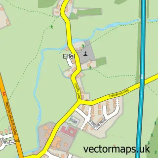
Galgate lies within Ellel Cp parish, part of Ellel ward in the Lancaster District (B) local authority area. The postcode geography for this area includes the LA postcode area, the LA2 postcode district and the LA2 0 postcode sector. Residents fall under the Nhs Lancashire And South Cumbria Integrated Care Board for NHS services.
Local features near Galgate
Within 2 milesAmenities and services in and around Galgate.
Administrative and postcode information for Galgate
The local authority covering Galgate is Lancaster District (B), within the county of Lancashire. The settlement lies within Ellel ward and Ellel Cp civil parish. The LA2 postcode district and LA2 0 postcode sector serve the immediate area. NHS provision in the area is delivered through University Hospitals Of Morecambe Bay Nhs Foundation Trust.
Nearby street map samples around Galgate

More street maps in Lancashire
750 metre map area coverage
Boundary, postcode and point of interest information for the 750m x 750m rectangle centred on this sample map.
Boundaries containing map centre
Constituency: Lancaster and Wyre Co Const
County: Lancashire County
District: Lancaster District (B)
Icb: NHS Lancashire and South Cumbria ICB
Parish: Ellel CP
Police Force: lancashire
Postcode District: LA2
Postcode Sector: LA2 0
Ward: Ellel Ward
Nearby boundaries intersecting sample
No additional intersecting boundaries found.
Postcode coverage
POI category counts
Automotive Repair: 3
Convenience Store: 3
Doctor: 3
Car Dealer: 2
Anglican Church: 1
Arts And Entertainment: 1
Assisted Living Facility: 1
Beauty Salon: 1
Beer Bar: 1
Building Supply Store: 1
Sample points of interest
- St John's Church
- Ajm Venue Finders
- Hillcroft House
- KLS Motors Ltd
- Rogersons Garage and The Landy Shop
- Silk Mill Garage
- Absolute beauty
- The Beer Hall
- France's Forestry & Landscaping
- John Taylor Cars
- R M Fisher
- L N Joinery
Create a larger editable map of Galgate
This sample shows only a 750 metre area. To create a larger map of Galgate, use our map builder to choose your own coverage area, add titles and download editable SVG, PDF and PNG files.
Create a custom map of Galgate