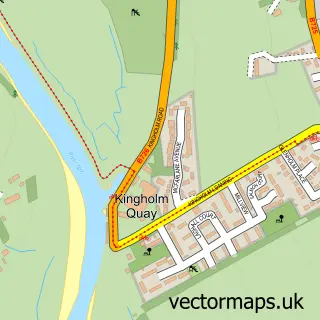
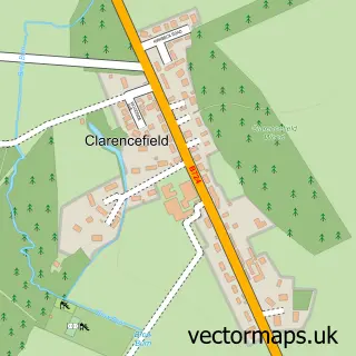
This Glencaple street map is a detailed vector street map covering a 750m x 750m area. Select a larger area to create and download your own vector street map of Glencaple.
The 750-metre map sample for Glencaple covers 92 mapped buildings and approximately 9.8 km of road detail, of which 7 named roads are named. The wider area around Glencaple features 2 food and drink venues and 1 hotel. To create a larger or custom map of Glencaple, the map builder lets you define your own coverage area and download editable SVG, PDF and PNG files.
Create a larger editable map of Glencaple
Choose any area you need and generate a high-quality vector map instantly. Perfect for print, planning, design, business and personal use.

This Glencaple street map in Dumfries is available as downloadable SVG, PDF and PNG map files, or as a printed map for planning, business, display, education, local information and design work. You can also create a larger custom map area using the map selector.
What this Glencaple map sample shows
Glencaple lies within Dumfries And Galloway parish, part of Nith ward in the Dumfries And Galloway local authority area. The postcode geography for this area includes the DG postcode area, the DG1 postcode district and the DG1 4 postcode sector. Residents fall under the Dumfries And Galloway for NHS services.
Local features near Glencaple
Within 2 milesAmenities and services in and around Glencaple.
Administrative and postcode information for Glencaple
Glencaple lies within Dumfries And Galloway parish, part of Nith ward in the Dumfries And Galloway local authority area. The postcode geography for this area includes the DG postcode area, the DG1 postcode district and the DG1 4 postcode sector. Residents fall under the Dumfries And Galloway for NHS services.
Nearby street map samples around Glencaple

More street maps in Dumfries
750 metre map area coverage
Boundary, postcode and point of interest information for the 750m x 750m rectangle centred on this sample map.
Boundaries containing map centre
Constituency: Dumfries and Galloway Co Const
District: Dumfries and Galloway
Icb: Dumfries and Galloway
Postcode District: DG1
Postcode Sector: DG1 4
Ward: Nith Ward
Nearby boundaries intersecting sample
No additional intersecting boundaries found.
Postcode coverage
POI category counts
Shipping Center: 2
Antique Store: 1
Auto Electrical Repair: 1
Bed And Breakfast: 1
Cafe: 1
Carpenter: 1
Community Center: 1
Contractor: 1
Electrician: 1
Elementary School: 1
Sample points of interest
- Vintageonthenith
- Colin Johnstone Electrical Contractor
- Shorepark Holiday Cottage
- The Boathouse
- John Anderson Joiner
- Barbour Memorial Hall
- Colin Johnstone
- Colin Johnstone & Son
- Caerlaverock Primary School
- Glencaple Lifeboat Station
- Glencaple Holiday Flat
- Nith Hotel
Create a larger editable map of Glencaple
This sample shows only a 750 metre area. To create a larger map of Glencaple, use our map builder to choose your own coverage area, add titles and download editable SVG, PDF and PNG files.
Create a custom map of Glencaple