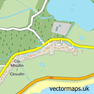
This Glenfinnan street map is a detailed vector street map covering a 750m x 750m area. Select a larger area to create and download your own vector street map of Glenfinnan.
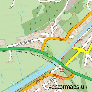
The 750-metre map sample for Glenfinnan covers 54 mapped buildings and approximately 7.6 km of road detail. The immediate area includes 1 railway station. The wider area around Glenfinnan features 2 tourism points of interest, 4 food and drink venues and 5 hotels. To create a larger or custom map of Glenfinnan, the map builder lets you define your own coverage area and download editable SVG, PDF and PNG files.
Create a larger editable map of Glenfinnan
Choose any area you need and generate a high-quality vector map instantly. Perfect for print, planning, design, business and personal use.

This Glenfinnan street map in Inverness is available as downloadable SVG, PDF and PNG map files, or as a printed map for planning, business, display, education, local information and design work. You can also create a larger custom map area using the map selector.
What this Glenfinnan map sample shows
Glenfinnan lies within Highland parish, part of Caol And Mallaig ward in the Highland local authority area. The postcode geography for this area includes the PH postcode area, the PH37 postcode district and the PH37 4 postcode sector. Residents fall under the Highland for NHS services.
Local features near Glenfinnan
Within 2 milesAmenities and services in and around Glenfinnan.
Administrative and postcode information for Glenfinnan
The local authority covering Glenfinnan is Highland, within the county of Inverness. The settlement lies within Caol And Mallaig ward and Highland civil parish. The PH37 postcode district and PH37 4 postcode sector serve the immediate area. NHS provision in the area is delivered through Highland.
Nearby street map samples around Glenfinnan

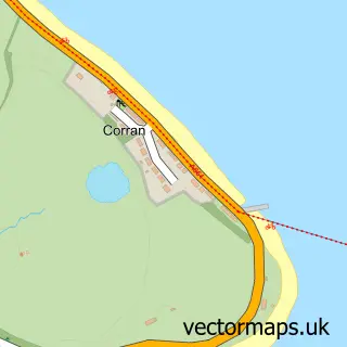
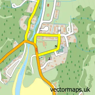
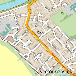
More street maps in Inverness
750 metre map area coverage
Boundary, postcode and point of interest information for the 750m x 750m rectangle centred on this sample map.
Boundaries containing map centre
Constituency: Inverness, Skye and West Ross-shire Co Const
District: Highland
Icb: Highland
Postcode District: PH37
Postcode Sector: PH37 4
Ward: Caol and Mallaig Ward
Nearby boundaries intersecting sample
Constituency: Argyll, Bute and South Lochaber Co Const
Ward: Fort William and Ardnamurchan Ward
Postcode coverage
POI category counts
Hotel: 5
Restaurant: 3
Church Cathedral: 2
Train Station: 2
Arts And Entertainment: 1
Boat Tours: 1
Coffee Shop: 1
Flowers And Gifts Shop: 1
History Museum: 1
Holiday Rental Home: 1
Sample points of interest
- Loch Shiel Festival
- Loch Shiel Cruises
- Glenfinnan Church
- St Mary and St Finnan's Chapel
- Glenfinnan Coffee Co.
- Rickshaw
- Glenfinnan Station Museum
- Old Laundry Studio (Glenfinnan)
- Glenfinnan Sleeping Car
- Back Track Bothies at Glenfinnan
- Camas Tana
- Glenfinnan House Hotel
Create a larger editable map of Glenfinnan
This sample shows only a 750 metre area. To create a larger map of Glenfinnan, use our map builder to choose your own coverage area, add titles and download editable SVG, PDF and PNG files.
Create a custom map of Glenfinnan