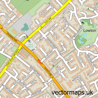
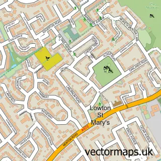
This Golborne street map is a detailed vector street map covering a 750m x 750m area. Select a larger area to create and download your own vector street map of Golborne.
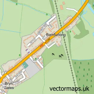
The 750-metre map sample for Golborne covers 383 mapped buildings and approximately 16.7 km of road detail, of which 52 named roads are named. The immediate area includes 3 schools, 3 GP surgeries, with 8 within 2 miles, 4 pubs and 2 MOT stations, with 12 within 2 miles. The wider area around Golborne features 2 tourism points of interest and 12 food and drink venues. To create a larger or custom map of Golborne, the map builder lets you define your own coverage area and download editable SVG, PDF and PNG files.
Create a larger editable map of Golborne
Choose any area you need and generate a high-quality vector map instantly. Perfect for print, planning, design, business and personal use.

This Golborne street map in Greater Manchester is available as downloadable SVG, PDF and PNG map files, or as a printed map for planning, business, display, education, local information and design work. You can also create a larger custom map area using the map selector.
What this Golborne map sample shows
Golborne lies within Wigan District (B) parish, part of Golborne And Lowton West ward in the Wigan District (B) local authority area. The postcode geography for this area includes the WA postcode area, the WA3 postcode district and the WA3 3 postcode sector. Residents fall under the Nhs Greater Manchester Integrated Care Board for NHS services.
Local features near Golborne
Within 2 milesAmenities and services in and around Golborne.
Administrative and postcode information for Golborne
The local authority covering Golborne is Wigan District (B), within the county of Greater Manchester. The settlement lies within Golborne And Lowton West ward and Wigan District (B) civil parish. The WA3 postcode district and WA3 3 postcode sector serve the immediate area. NHS provision in the area is delivered through Wrightington, Wigan And Leigh Nhs Foundation Trust.
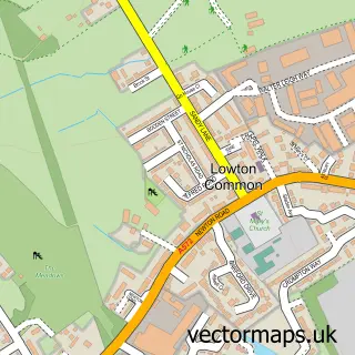
Nearby street map samples around Golborne

More street maps in Greater Manchester
750 metre map area coverage
Boundary, postcode and point of interest information for the 750m x 750m rectangle centred on this sample map.
Boundaries containing map centre
Constituency: Leigh and Atherton Boro Const
District: Wigan District (B)
Icb: NHS Greater Manchester ICB
Police Force: greater manchester
Postcode District: WA3
Postcode Sector: WA3 3
Ward: Golborne & Lowton West Ward
Nearby boundaries intersecting sample
No additional intersecting boundaries found.
Postcode coverage
POI category counts
Beauty Salon: 13
Doctor: 7
Restaurant: 7
Professional Services: 6
Automotive Repair: 5
Beauty And Spa: 4
Church Cathedral: 4
Pub: 4
Barber: 3
Chinese Restaurant: 3
Sample points of interest
- Primus Accountancy
- Eleven30 Group
- Wigan & Leigh Hospice Shop
- Phoenix Pottery and Art Studio
- Kaleidoscope Parties - Adamcadabra
- ATM (Post Office)
- Cross Auto Restorations | Golborne
- Spraywise
- Close Attention Detailing
- East Lancs Fiat Spares
- Stoney's Scooter Shack
- Ashcrofts Service and MOT Centre
Create a larger editable map of Golborne
This sample shows only a 750 metre area. To create a larger map of Golborne, use our map builder to choose your own coverage area, add titles and download editable SVG, PDF and PNG files.
Create a custom map of Golborne