Vector Maps logo
Home Why it works Popular maps Districts Samples Customizer Create Your Map
VectorMaps.uk
Home Popular maps Districts Samples Customizer Create Your Map Privacy Disclaimer
Home / UK Maps / Greater Manchester / Edge Green Map

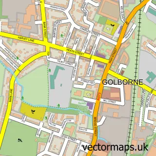
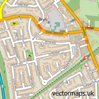
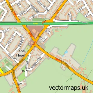
This Edge Green street map is a detailed vector street map covering a 750m x 750m area. Select a larger area to create and download your own vector street map of Edge Green.

Edge Green is a village in Greater Manchester, in the North West of England. Historically, the area formed part of Lancashire. The settlement falls within the Makerfield parliamentary constituency. It is served by the WN4 postcode district, with WN4 8 as

The 750-metre map sample for Edge Green covers 149 mapped buildings and approximately 10.4 km of road detail, of which 13 named roads are named. The immediate area includes 9 GP surgeries within 2 miles and 13 MOT stations within 2 miles. To create a larger or custom map of Edge Green, the map builder lets you define your own coverage area and download editable SVG, PDF and PNG files.

149Buildings
10.44 kmRoads
13Named roads
19,536Residents within 2 miles
Create your own

Create a larger editable map of Edge Green

Choose any area you need and generate a high-quality vector map instantly. Perfect for print, planning, design, business and personal use.

Choose any location
Editable SVG files
Any size up to A0
PDF, PNG & more
Instant download
High quality guaranteed
Create My Custom Map
Secure, private & no credit card required
Edge Green Vector Street Map
750m Sample
Edge Green vector street map sample showing roads, buildings and local features in a 750 metre preview area
Buy Edge Green Map Print from £12.95 Buy Edge Green Digital Map from £6

This Edge Green street map in Greater Manchester is available as downloadable SVG, PDF and PNG map files, or as a printed map for planning, business, display, education, local information and design work. You can also create a larger custom map area using the map selector.

What this Edge Green map sample shows

Edge Green lies within Wigan District (B) parish, part of Ashton ward in the Wigan District (B) local authority area. The postcode geography for this area includes the WN postcode area, the WN4 postcode district and the WN4 8 postcode sector. Residents fall under the Nhs Greater Manchester Integrated Care Board for NHS services.

Local features near Edge Green

Within 2 miles

Amenities and services in and around Edge Green.

9 GP surgeries within 2 miles
13 MOT stations within 2 miles

Counts are approximate and based on publicly available data.

Administrative and postcode information for Edge Green

The local authority covering Edge Green is Wigan District (B), within the county of Greater Manchester. The settlement lies within Ashton ward and Wigan District (B) civil parish. The WN4 postcode district and WN4 8 postcode sector serve the immediate area. NHS provision in the area is delivered through Wrightington, Wigan And Leigh Nhs Foundation Trust.

Parish WIGAN DISTRICT (B)
Ward Ashton
District / local authority Wigan District (B)
County Greater Manchester
Historic county Lancashire
Postcode district WN4
Postcode sector WN4 8
Parliamentary constituency Makerfield
Region North West
Country England

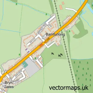
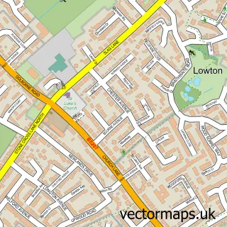
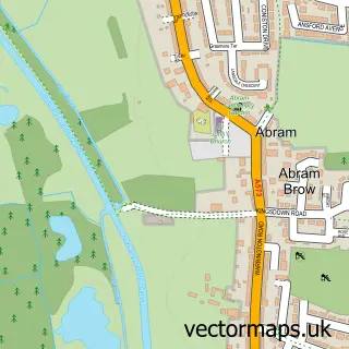
Nearby street map samples around Edge Green

Street map sample of Golborne, Greater Manchester Golborne Town - Greater Manchester - 0.9 miles Street map sample of Salford, Greater Manchester Salford City - Greater Manchester - 13.2 miles Street map sample of Bamfurlong, Greater Manchester Bamfurlong Village - Greater Manchester - 1.5 miles Street map sample of Lowton St Luke's, Greater Manchester Lowton St Luke's Village - Greater Manchester - 1.6 miles Street map sample of Abram, Greater Manchester Abram Village - Greater Manchester - 1.6 miles Street map sample of Bryn, Greater Manchester Bryn Village - Greater Manchester - 1.9 miles Street map sample of Town of Lowton, Greater Manchester Town of Lowton Village - Greater Manchester - 2.0 miles Street map sample of Platt Bridge, Greater Manchester Platt Bridge Village - Greater Manchester - 2.2 miles Street map sample of Lowton St Mary's, Greater Manchester Lowton St Mary's Village - Greater Manchester - 2.2 miles Street map sample of Lane Head, Greater Manchester Lane Head Village - Greater Manchester - 2.3 miles

More street maps in Greater Manchester

Street map sample of Golborne, Greater Manchester Golborne Town - 0.9 miles Street map sample of Ashton-in-Makerfield, Greater Manchester Ashton-in-Makerfield Town - 1.3 miles Street map sample of Bamfurlong, Greater Manchester Bamfurlong Village - 1.5 miles Street map sample of Lowton St Luke's, Greater Manchester Lowton St Luke's Village - 1.6 miles Street map sample of Abram, Greater Manchester Abram Village - 1.6 miles

750 metre map area coverage

Boundary, postcode and point of interest information for the 750m x 750m rectangle centred on this sample map.

Boundaries containing map centre

Constituency: Leigh and Atherton Boro Const

District: Wigan District (B)

Icb: NHS Greater Manchester ICB

Police Force: greater manchester

Postcode District: WA3

Postcode Sector: WA3 3

Ward: Golborne & Lowton West Ward

Nearby boundaries intersecting sample

Constituency: Makerfield Boro Const

Postcode District: WN4

Postcode Sector: WN4 8

Postcode coverage

WA3 WA3 3 WN4 WN4 8

POI category counts

Building Supply Store: 1

Driving Range: 1

Financial Service: 1

Fishing Club: 1

Freight And Cargo Service: 1

Masonry Concrete: 1

Professional Services: 1

Sports Club And League: 1

Sample points of interest

  • Sabel Gardening Building Supply Store
  • Sycamores Golf Centre Driving Range
  • LP Bookkeeping Financial Service
  • Sycamore Fisheries Fishing Club
  • Express It UK Freight And Cargo Service
  • Hanson Asphalt & Contracting Masonry Concrete
  • Wigan Turf & Top Soil Professional Services
  • Golborne Community Badminton Sports Club And League

Create a larger editable map of Edge Green

This sample shows only a 750 metre area. To create a larger map of Edge Green, use our map builder to choose your own coverage area, add titles and download editable SVG, PDF and PNG files.

Create a custom map of Edge Green

Phone 01751 473136 | Copyright Vectormaps.uk 2026

Samples Customizer Privacy Disclaimer
Edge Green Vector Street Map
Edge Green enlarged street map sample showing a 750 metre preview area