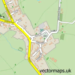
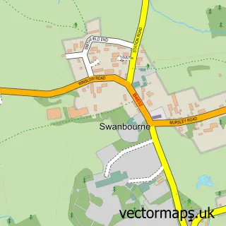
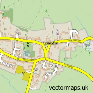
This Granborough street map is a detailed vector street map covering a 750m x 750m area. Select a larger area to create and download your own vector street map of Granborough.
The 750-metre map sample for Granborough covers 181 mapped buildings and approximately 19.3 km of road detail, of which 11 named roads are named. The immediate area includes 1 pub. The wider area around Granborough features 1 food and drink venue. To create a larger or custom map of Granborough, the map builder lets you define your own coverage area and download editable SVG, PDF and PNG files.
Create a larger editable map of Granborough
Choose any area you need and generate a high-quality vector map instantly. Perfect for print, planning, design, business and personal use.

This Granborough street map in Buckinghamshire is available as downloadable SVG, PDF and PNG map files, or as a printed map for planning, business, display, education, local information and design work. You can also create a larger custom map area using the map selector.
What this Granborough map sample shows
Granborough lies within Granborough Cp parish, part of Quainton ward in the Buckinghamshire local authority area. The postcode geography for this area includes the MK postcode area, the MK18 postcode district and the MK18 3 postcode sector. Residents fall under the Nhs Buckinghamshire, Oxfordshire And Berkshire West Integrated Care Board for NHS services.
Local features near Granborough
Within 2 milesAmenities and services in and around Granborough.
Administrative and postcode information for Granborough
The local authority covering Granborough is Buckinghamshire, within the county of Buckinghamshire. The settlement lies within Quainton ward and Granborough Cp civil parish. The MK18 postcode district and MK18 3 postcode sector serve the immediate area. NHS provision in the area is delivered through Milton Keynes University Hospital Nhs Foundation Trust.
Nearby street map samples around Granborough

More street maps in Buckinghamshire
750 metre map area coverage
Boundary, postcode and point of interest information for the 750m x 750m rectangle centred on this sample map.
Boundaries containing map centre
Constituency: Buckingham and Bletchley Co Const
District: Buckinghamshire
Icb: NHS Thames Valley ICB
Parish: Granborough CP
Police Force: thames valley
Postcode District: MK18
Postcode Sector: MK18 3
Ward: Quainton Ward
Nearby boundaries intersecting sample
No additional intersecting boundaries found.
Postcode coverage
POI category counts
Anglican Church: 1
Business Consulting: 1
Community Center: 1
Educational Services: 1
Fish And Chips Restaurant: 1
Graphic Designer: 1
International Business And Trade Services: 1
Marketing Agency: 1
Pub: 1
Talent Agency: 1
Sample points of interest
- Granborough: St John the Baptist
- BMW Associates
- Granborough Village Hall
- Anthill Health & Safety Consultancy & Training Uk
- Howe & Co 66 Frankly Fish and Chips
- Crackerjackdesign
- Architectyourhome
- Bigview Digital
- The Crown Granborough
- Mayhem Productions
Create a larger editable map of Granborough
This sample shows only a 750 metre area. To create a larger map of Granborough, use our map builder to choose your own coverage area, add titles and download editable SVG, PDF and PNG files.
Create a custom map of Granborough