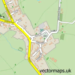
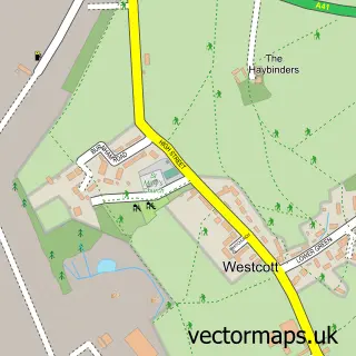
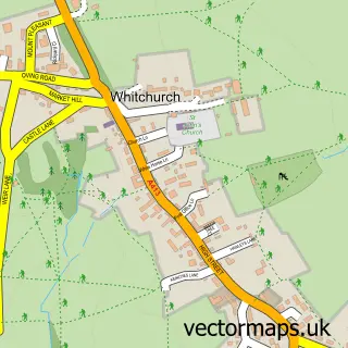
This Quainton street map is a detailed vector street map covering a 750m x 750m area. Select a larger area to create and download your own vector street map of Quainton.
The 750-metre map sample for Quainton covers 229 mapped buildings and approximately 15.0 km of road detail, of which 15 named roads are named. The immediate area includes 1 school, 1 pub and 1 MOT station, with 2 within 2 miles. The wider area around Quainton features 1 tourism point of interest, 1 food and drink venue and 1 hotel. To create a larger or custom map of Quainton, the map builder lets you define your own coverage area and download editable SVG, PDF and PNG files.
Create a larger editable map of Quainton
Choose any area you need and generate a high-quality vector map instantly. Perfect for print, planning, design, business and personal use.

This Quainton street map in Buckinghamshire is available as downloadable SVG, PDF and PNG map files, or as a printed map for planning, business, display, education, local information and design work. You can also create a larger custom map area using the map selector.
What this Quainton map sample shows
Quainton lies within Quainton Cp parish, part of Quainton ward in the Buckinghamshire local authority area. The postcode geography for this area includes the HP postcode area, the HP22 postcode district and the HP22 4 postcode sector. Residents fall under the Nhs Buckinghamshire, Oxfordshire And Berkshire West Integrated Care Board for NHS services.
Local features near Quainton
Within 2 milesAmenities and services in and around Quainton.
Administrative and postcode information for Quainton
Quainton lies within Quainton Cp parish, part of Quainton ward in the Buckinghamshire local authority area. The postcode geography for this area includes the HP postcode area, the HP22 postcode district and the HP22 4 postcode sector. Residents fall under the Nhs Buckinghamshire, Oxfordshire And Berkshire West Integrated Care Board for NHS services.
Nearby street map samples around Quainton

More street maps in Buckinghamshire
750 metre map area coverage
Boundary, postcode and point of interest information for the 750m x 750m rectangle centred on this sample map.
Boundaries containing map centre
Constituency: Buckingham and Bletchley Co Const
District: Buckinghamshire
Icb: NHS Thames Valley ICB
Parish: Quainton CP
Police Force: thames valley
Postcode District: HP22
Postcode Sector: HP22 4
Ward: Quainton Ward
Nearby boundaries intersecting sample
No additional intersecting boundaries found.
Postcode coverage
POI category counts
Church Cathedral: 4
Photography Store And Services: 2
Post Office: 2
Anglican Church: 1
Audio Visual Production And Design: 1
Automotive Repair: 1
Barber: 1
Building Supply Store: 1
Carpet Store: 1
Convenience Store: 1
Sample points of interest
- Quainton Holy Cross and St Mary
- Cineworx Ltd.
- Quainton Garage
- Hair By Kim
- Pete Leybourne
- Quainton Carpets
- Holy Cross & St Mary C of E Church
- Holy Cross and St Mary's Church
- Quainton Church Fundraising
- St Mary's Church, Quainton
- Quainton Village Store
- 360 Training
Create a larger editable map of Quainton
This sample shows only a 750 metre area. To create a larger map of Quainton, use our map builder to choose your own coverage area, add titles and download editable SVG, PDF and PNG files.
Create a custom map of Quainton