This Grantown-on-Spey street map is a detailed vector street map covering a 750m x 750m area. Select a larger area to create and download your own vector street map of Grantown-on-Spey.
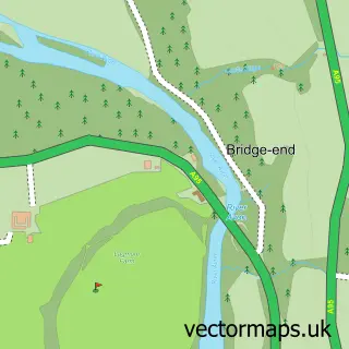
The 750-metre map sample for Grantown-on-Spey covers 492 mapped buildings and approximately 20.8 km of road detail, of which 35 named roads are named. The immediate area includes 1 GP surgery within 2 miles, 1 pub and 1 MOT station, with 2 within 2 miles. The wider area around Grantown-on-Spey features 3 tourism points of interest, 10 food and drink venues and 9 hotels. To create a larger or custom map of Grantown-on-Spey, the map builder lets you define your own coverage area and download editable SVG, PDF and PNG files.
Create a larger editable map of Grantown-on-Spey
Choose any area you need and generate a high-quality vector map instantly. Perfect for print, planning, design, business and personal use.

This Grantown-on-Spey street map in Inverness is available as downloadable SVG, PDF and PNG map files, or as a printed map for planning, business, display, education, local information and design work. You can also create a larger custom map area using the map selector.
What this Grantown-on-Spey map sample shows
Grantown-on-Spey lies within Highland parish, part of Badenoch And Strathspey ward in the Highland local authority area. The postcode geography for this area includes the PH postcode area, the PH26 postcode district and the PH26 3 postcode sector. Residents fall under the Highland for NHS services.
Local features near Grantown-on-Spey
Within 2 milesAmenities and services in and around Grantown-on-Spey.
Administrative and postcode information for Grantown-on-Spey
Grantown-on-Spey lies within Highland parish, part of Badenoch And Strathspey ward in the Highland local authority area. The postcode geography for this area includes the PH postcode area, the PH26 postcode district and the PH26 3 postcode sector. Residents fall under the Highland for NHS services.
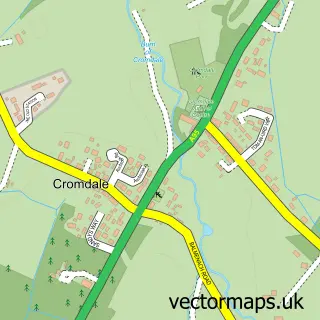
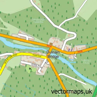
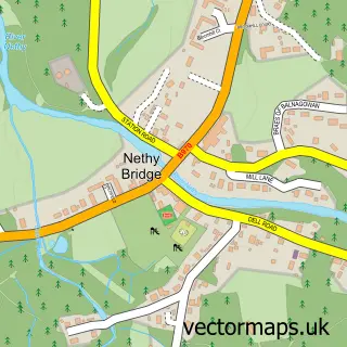
Nearby street map samples around Grantown-on-Spey

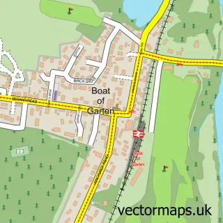
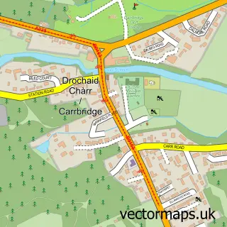
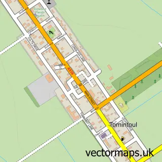
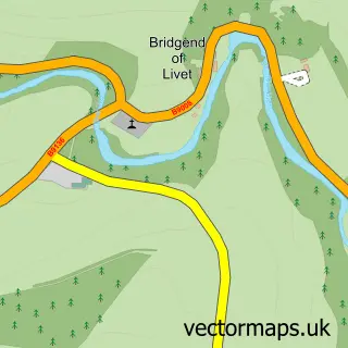
More street maps in Inverness
750 metre map area coverage
Boundary, postcode and point of interest information for the 750m x 750m rectangle centred on this sample map.
Boundaries containing map centre
Constituency: Moray West, Nairn and Strathspey Co Const
District: Highland
Icb: Highland
Postcode District: PH26
Postcode Sector: PH26 3
Ward: Badenoch and Strathspey Ward
Nearby boundaries intersecting sample
No additional intersecting boundaries found.
Postcode coverage
POI category counts
Bed And Breakfast: 20
Hotel: 9
Flowers And Gifts Shop: 6
Beauty Salon: 5
Convenience Store: 5
Coffee Shop: 4
Professional Services: 4
Bakery: 3
Bank Credit Union: 3
Charity Organization: 3
Sample points of interest
- Grantown on Spey
- Mount Barker
- The Granary In The Square
- Openspace The Vault
- Spey Bank Studio
- Smarty Art
- Angus Grant Art
- The Avenue - Grantown
- Grand View House Nursing Home
- The Cooperative Food (BF) Grantown On Spey
- James A Grant
- CFS Services Scotland LTD
Create a larger editable map of Grantown-on-Spey
This sample shows only a 750 metre area. To create a larger map of Grantown-on-Spey, use our map builder to choose your own coverage area, add titles and download editable SVG, PDF and PNG files.
Create a custom map of Grantown-on-Spey