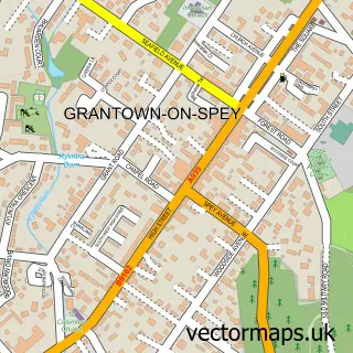
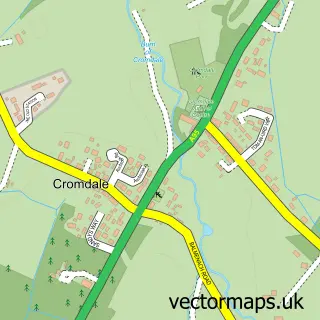
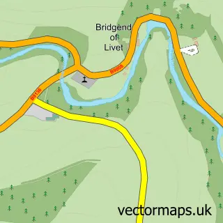
This Nethy Bridge street map is a detailed vector street map covering a 750m x 750m area. Select a larger area to create and download your own vector street map of Nethy Bridge.
The 750-metre map sample for Nethy Bridge covers 169 mapped buildings and approximately 11.5 km of road detail, of which 6 named roads are named. The wider area around Nethy Bridge features 3 tourism points of interest, 1 food and drink venue and 5 hotels. To create a larger or custom map of Nethy Bridge, the map builder lets you define your own coverage area and download editable SVG, PDF and PNG files.
Create a larger editable map of Nethy Bridge
Choose any area you need and generate a high-quality vector map instantly. Perfect for print, planning, design, business and personal use.

This Nethy Bridge street map in Inverness is available as downloadable SVG, PDF and PNG map files, or as a printed map for planning, business, display, education, local information and design work. You can also create a larger custom map area using the map selector.
What this Nethy Bridge map sample shows
Nethy Bridge lies within Highland parish, part of Badenoch And Strathspey ward in the Highland local authority area. The postcode geography for this area includes the PH postcode area, the PH25 postcode district and the PH25 3 postcode sector. Residents fall under the Highland for NHS services.
Local features near Nethy Bridge
Within 2 milesAmenities and services in and around Nethy Bridge.
Administrative and postcode information for Nethy Bridge
Nethy Bridge lies within Highland parish, part of Badenoch And Strathspey ward in the Highland local authority area. The postcode geography for this area includes the PH postcode area, the PH25 postcode district and the PH25 3 postcode sector. Residents fall under the Highland for NHS services.
Nearby street map samples around Nethy Bridge

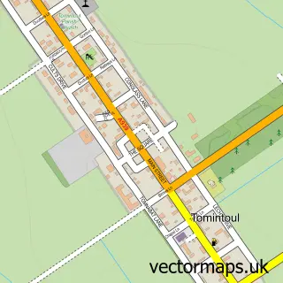
More street maps in Inverness
750 metre map area coverage
Boundary, postcode and point of interest information for the 750m x 750m rectangle centred on this sample map.
Boundaries containing map centre
Constituency: Moray West, Nairn and Strathspey Co Const
District: Highland
Icb: Highland
Postcode District: PH25
Postcode Sector: PH25 3
Ward: Badenoch and Strathspey Ward
Nearby boundaries intersecting sample
No additional intersecting boundaries found.
Postcode coverage
POI category counts
Hotel: 5
Convenience Store: 2
Bed And Breakfast: 1
Building Supply Store: 1
Butcher Shop: 1
Cafe: 1
Campground: 1
Catholic Church: 1
Community Services Non Profits: 1
Elementary School: 1
Sample points of interest
- The Manse
- HSM Builders
- Balliefurth Farm Shop
- Nethy House
- Mondhuie Chalets & B & B
- Abernethy
- Nethy Bridge - Community
- Premier Nethy Bridge
- SPAR
- Abernethy Primary School
- Alban Tree Care
- Tigh-Na-Fraoch
Create a larger editable map of Nethy Bridge
This sample shows only a 750 metre area. To create a larger map of Nethy Bridge, use our map builder to choose your own coverage area, add titles and download editable SVG, PDF and PNG files.
Create a custom map of Nethy Bridge