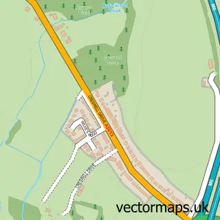
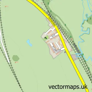
This Great Bridgeford street map is a detailed vector street map covering a 750m x 750m area. Select a larger area to create and download your own vector street map of Great Bridgeford.
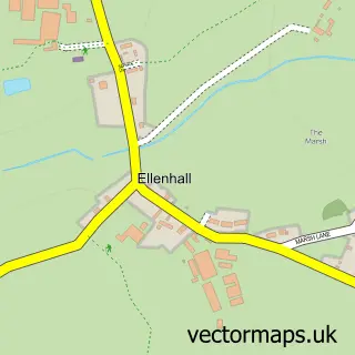
The 750-metre map sample for Great Bridgeford covers 179 mapped buildings and approximately 11.3 km of road detail, of which 11 named roads are named. The immediate area includes 5 MOT stations within 2 miles. The wider area around Great Bridgeford features 1 tourism point of interest. To create a larger or custom map of Great Bridgeford, the map builder lets you define your own coverage area and download editable SVG, PDF and PNG files.
Create a larger editable map of Great Bridgeford
Choose any area you need and generate a high-quality vector map instantly. Perfect for print, planning, design, business and personal use.

This Great Bridgeford street map in Staffordshire is available as downloadable SVG, PDF and PNG map files, or as a printed map for planning, business, display, education, local information and design work. You can also create a larger custom map area using the map selector.
What this Great Bridgeford map sample shows
Great Bridgeford lies within Seighford Cp parish, part of Seighford & Church Eaton ward in the Stafford District (B) local authority area. The postcode geography for this area includes the ST postcode area, the ST18 postcode district and the ST18 9 postcode sector. Residents fall under the Nhs Staffordshire And Stoke-On-Trent Integrated Care Board for NHS services.
Local features near Great Bridgeford
Within 2 milesAmenities and services in and around Great Bridgeford.
Administrative and postcode information for Great Bridgeford
Great Bridgeford lies within Seighford Cp parish, part of Seighford & Church Eaton ward in the Stafford District (B) local authority area. The postcode geography for this area includes the ST postcode area, the ST18 postcode district and the ST18 9 postcode sector. Residents fall under the Nhs Staffordshire And Stoke-On-Trent Integrated Care Board for NHS services.
Nearby street map samples around Great Bridgeford
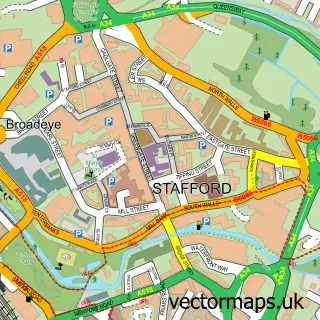

More street maps in Staffordshire
750 metre map area coverage
Boundary, postcode and point of interest information for the 750m x 750m rectangle centred on this sample map.
Boundaries containing map centre
Constituency: Stafford Co Const
County: Staffordshire County
District: Stafford District (B)
Icb: NHS Staffordshire and Stoke-on-Trent ICB
Parish: Seighford CP
Police Force: staffordshire
Postcode District: ST18
Postcode Sector: ST18 9
Ward: Seighford & Church Eaton Ward
Nearby boundaries intersecting sample
No additional intersecting boundaries found.
Postcode coverage
POI category counts
Agricultural Service: 2
Alternative Medicine: 1
Building Supply Store: 1
Dance School: 1
Driving School: 1
Employment Agencies: 1
Engineering Services: 1
It Service And Computer Repair: 1
Park: 1
Performing Arts: 1
Sample points of interest
- Grain Management by Hartley Farms
- Hartley Farm’s Grainmanagement
- Natural Health & Healing
- J E S Electrical Ltd
- Toqua Tango
- Learner2Advanced
- High Meadow Recruitment
- David Price Associates
- SLS Computing
- Code Y Brenin Forest Park
- Tony And Tinkerbell Magic Show
- Great Bridgeford Post Office
Create a larger editable map of Great Bridgeford
This sample shows only a 750 metre area. To create a larger map of Great Bridgeford, use our map builder to choose your own coverage area, add titles and download editable SVG, PDF and PNG files.
Create a custom map of Great Bridgeford