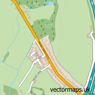
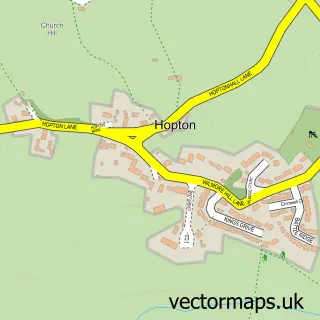
This Doxey street map is a detailed vector street map covering a 750m x 750m area. Select a larger area to create and download your own vector street map of Doxey.
The 750-metre map sample for Doxey covers 393 mapped buildings and approximately 12.1 km of road detail, of which 34 named roads are named. The immediate area includes 1 school, 6 GP surgeries within 2 miles and 27 MOT stations within 2 miles. The wider area around Doxey features 1 tourism point of interest and 1 hotel. To create a larger or custom map of Doxey, the map builder lets you define your own coverage area and download editable SVG, PDF and PNG files.
Create a larger editable map of Doxey
Choose any area you need and generate a high-quality vector map instantly. Perfect for print, planning, design, business and personal use.

This Doxey street map in Staffordshire is available as downloadable SVG, PDF and PNG map files, or as a printed map for planning, business, display, education, local information and design work. You can also create a larger custom map area using the map selector.
What this Doxey map sample shows
Doxey lies within Doxey Cp parish, part of Doxey & Castletown ward in the Stafford District (B) local authority area. The postcode geography for this area includes the ST postcode area, the ST16 postcode district and the ST16 1 postcode sector. Residents fall under the Nhs Staffordshire And Stoke-On-Trent Integrated Care Board for NHS services.
Local features near Doxey
Within 2 milesAmenities and services in and around Doxey.
Administrative and postcode information for Doxey
The local authority covering Doxey is Stafford District (B), within the county of Staffordshire. The settlement lies within Doxey & Castletown ward and Doxey Cp civil parish. The ST16 postcode district and ST16 1 postcode sector serve the immediate area. NHS provision in the area is delivered through University Hospitals Of North Midlands Nhs Trust.
Nearby street map samples around Doxey

More street maps in Staffordshire
750 metre map area coverage
Boundary, postcode and point of interest information for the 750m x 750m rectangle centred on this sample map.
Boundaries containing map centre
Constituency: Stafford Co Const
County: Staffordshire County
District: Stafford District (B)
Icb: NHS Staffordshire and Stoke-on-Trent ICB
Parish: Doxey CP
Police Force: staffordshire
Postcode District: ST16
Postcode Sector: ST16 1
Ward: Doxey & Castletown Ward
Nearby boundaries intersecting sample
No additional intersecting boundaries found.
Postcode coverage
POI category counts
Convenience Store: 3
Pet Groomer: 3
Arts And Entertainment: 2
Garbage Collection Service: 2
Gardener: 2
Retail: 2
Anglican Church: 1
Atms: 1
Beauty Salon: 1
Building Supply Store: 1
Sample points of interest
- S.Thomas & S.Andrew, Doxey
- Drawpets
- Ten Pin Bowling
- PayPoint
- Tia David Nails
- Lucoli Property Services
- Camco Transport
- St Thomas and St Andrews Church
- OVENU(Stafford)
- Saint Gobain Abrasives
- Doxey Hub Community Centre
- NTCG Stafford
Create a larger editable map of Doxey
This sample shows only a 750 metre area. To create a larger map of Doxey, use our map builder to choose your own coverage area, add titles and download editable SVG, PDF and PNG files.
Create a custom map of Doxey