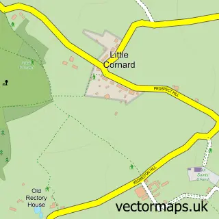
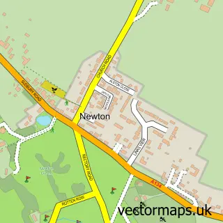
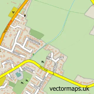
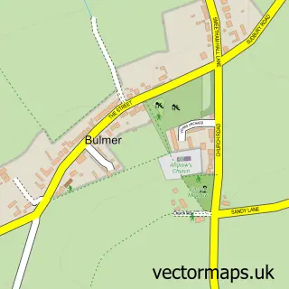
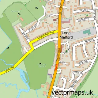
This Great Cornard street map is a detailed vector street map covering a 750m x 750m area. Select a larger area to create and download your own vector street map of Great Cornard.
The 750-metre map sample for Great Cornard covers 614 mapped buildings and approximately 18.2 km of road detail, of which 39 named roads are named. The immediate area includes 2 GP surgeries within 2 miles and 12 MOT stations within 2 miles. The wider area around Great Cornard features 1 hotel. To create a larger or custom map of Great Cornard, the map builder lets you define your own coverage area and download editable SVG, PDF and PNG files.
Create a larger editable map of Great Cornard
Choose any area you need and generate a high-quality vector map instantly. Perfect for print, planning, design, business and personal use.

This Great Cornard street map in Suffolk is available as downloadable SVG, PDF and PNG map files, or as a printed map for planning, business, display, education, local information and design work. You can also create a larger custom map area using the map selector.
What this Great Cornard map sample shows
Great Cornard lies within Great Cornard Cp parish, part of Great Cornard ward in the Babergh District local authority area. The postcode geography for this area includes the CO postcode area, the CO10 postcode district and the CO10 0 postcode sector. Residents fall under the Nhs Suffolk And North East Essex Integrated Care Board for NHS services.
Local features near Great Cornard
Within 2 milesAmenities and services in and around Great Cornard.
Administrative and postcode information for Great Cornard
Great Cornard lies within Great Cornard Cp parish, part of Great Cornard ward in the Babergh District local authority area. The postcode geography for this area includes the CO postcode area, the CO10 postcode district and the CO10 0 postcode sector. Residents fall under the Nhs Suffolk And North East Essex Integrated Care Board for NHS services.
Nearby street map samples around Great Cornard

More street maps in Suffolk
750 metre map area coverage
Boundary, postcode and point of interest information for the 750m x 750m rectangle centred on this sample map.
Boundaries containing map centre
Constituency: South Suffolk Co Const
County: Suffolk County
District: Babergh District
Icb: NHS Essex ICB
Parish: Great Cornard CP
Police Force: suffolk
Postcode District: CO10
Postcode Sector: CO10 0
Ward: Great Cornard Ward
Nearby boundaries intersecting sample
No additional intersecting boundaries found.
Postcode coverage
POI category counts
Church Cathedral: 3
Community Center: 3
Doctor: 2
Electrician: 2
Flowers And Gifts Shop: 2
Naturopathic Holistic: 2
Professional Services: 2
Retirement Home: 2
Taxi Service: 2
Anglican Church: 1
Sample points of interest
- St Andrew's, Great Cornard
- Auto Addiction Detailing
- Sjw Audio Vehicle Installations
- Queens Arms
- Perfect 10 Nails and Beauty
- Danny's Professional Cleaning
- Paddlesports Coaching
- Etiquette Catering Equipment Hire
- Scofield Chiropractic Clinic
- Cornard Christian Fellowship
- Cornard Christian Fellowship
- St Andrew's Church
Create a larger editable map of Great Cornard
This sample shows only a 750 metre area. To create a larger map of Great Cornard, use our map builder to choose your own coverage area, add titles and download editable SVG, PDF and PNG files.
Create a custom map of Great Cornard