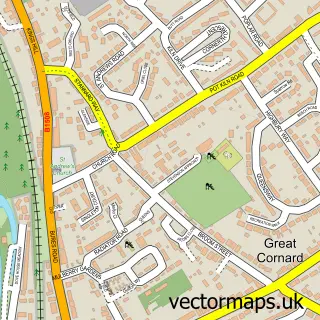
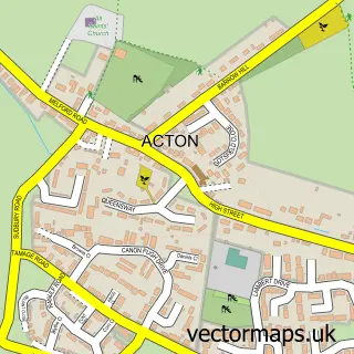
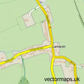
This Sudbury street map is a detailed vector street map covering a 750m x 750m area. Select a larger area to create and download your own vector street map of Sudbury.
The 750-metre map sample for Sudbury covers 426 mapped buildings and approximately 23.7 km of road detail, of which 61 named roads are named. The immediate area includes 1 school, 1 GP surgery, with 2 within 2 miles, 17 pubs and 2 MOT stations, with 12 within 2 miles. The wider area around Sudbury features 3 tourism points of interest, 48 food and drink venues and 3 hotels. To create a larger or custom map of Sudbury, the map builder lets you define your own coverage area and download editable SVG, PDF and PNG files.
Create a larger editable map of Sudbury
Choose any area you need and generate a high-quality vector map instantly. Perfect for print, planning, design, business and personal use.

This Sudbury street map in Suffolk is available as downloadable SVG, PDF and PNG map files, or as a printed map for planning, business, display, education, local information and design work. You can also create a larger custom map area using the map selector.
What this Sudbury map sample shows
Sudbury lies within Sudbury Cp parish, part of Sudbury North West ward in the Babergh District local authority area. The postcode geography for this area includes the CO postcode area, the CO10 postcode district and the CO10 1 postcode sector. Residents fall under the Nhs Suffolk And North East Essex Integrated Care Board for NHS services.
Local features near Sudbury
Within 2 milesAmenities and services in and around Sudbury.
Administrative and postcode information for Sudbury
Sudbury lies within Sudbury Cp parish, part of Sudbury North West ward in the Babergh District local authority area. The postcode geography for this area includes the CO postcode area, the CO10 postcode district and the CO10 1 postcode sector. Residents fall under the Nhs Suffolk And North East Essex Integrated Care Board for NHS services.
Nearby street map samples around Sudbury

More street maps in Suffolk
750 metre map area coverage
Boundary, postcode and point of interest information for the 750m x 750m rectangle centred on this sample map.
Boundaries containing map centre
Constituency: South Suffolk Co Const
County: Suffolk County
District: Babergh District
Icb: NHS Essex ICB
Parish: Sudbury CP
Police Force: suffolk
Postcode District: CO10
Postcode Sector: CO10 1
Ward: Sudbury North West Ward
Nearby boundaries intersecting sample
Postcode Sector: CO10 2
Ward: Sudbury South East Ward, Sudbury South West Ward
Postcode coverage
POI category counts
Beauty Salon: 19
Pub: 17
Cafe: 15
Hair Salon: 13
Barber: 10
Clothing Store: 10
Professional Services: 10
Real Estate Agent: 10
Tattoo And Piercing: 10
Church Cathedral: 9
Sample points of interest
- Moore Green Chartered Accountants
- Stacey & Partners
- T-A Accounts
- Bridge End
- Jenny Anderson Acupuncture
- Soul Connection Acupuncture
- Radish Design
- Star Illustration
- The Ark Design Consultancy
- Beautiful Sole Reflexology
- Sudbury Hypnosis
- St Gregory's Church
Create a larger editable map of Sudbury
This sample shows only a 750 metre area. To create a larger map of Sudbury, use our map builder to choose your own coverage area, add titles and download editable SVG, PDF and PNG files.
Create a custom map of Sudbury