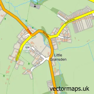
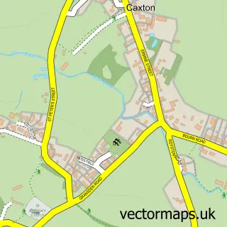
This Great Gransden street map is a detailed vector street map covering a 750m x 750m area. Select a larger area to create and download your own vector street map of Great Gransden.
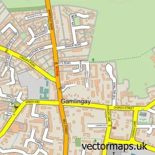
The 750-metre map sample for Great Gransden covers 370 mapped buildings and approximately 12.3 km of road detail, of which 21 named roads are named. The immediate area includes 1 school and 1 MOT station within 2 miles. To create a larger or custom map of Great Gransden, the map builder lets you define your own coverage area and download editable SVG, PDF and PNG files.
Create a larger editable map of Great Gransden
Choose any area you need and generate a high-quality vector map instantly. Perfect for print, planning, design, business and personal use.

This Great Gransden street map in Cambridgeshire is available as downloadable SVG, PDF and PNG map files, or as a printed map for planning, business, display, education, local information and design work. You can also create a larger custom map area using the map selector.
What this Great Gransden map sample shows
Great Gransden lies within Great Gransden Cp parish, part of Great Paxton ward in the Huntingdonshire District local authority area. The postcode geography for this area includes the SG postcode area, the SG19 postcode district and the SG19 3 postcode sector. Residents fall under the Nhs Cambridgeshire And Peterborough Integrated Care Board for NHS services.
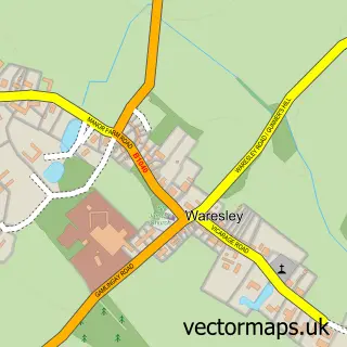
Local features near Great Gransden
Within 2 milesAmenities and services in and around Great Gransden.
Administrative and postcode information for Great Gransden
Great Gransden lies within Great Gransden Cp parish, part of Great Paxton ward in the Huntingdonshire District local authority area. The postcode geography for this area includes the SG postcode area, the SG19 postcode district and the SG19 3 postcode sector. Residents fall under the Nhs Cambridgeshire And Peterborough Integrated Care Board for NHS services.
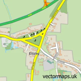
Nearby street map samples around Great Gransden

More street maps in Cambridgeshire
750 metre map area coverage
Boundary, postcode and point of interest information for the 750m x 750m rectangle centred on this sample map.
Boundaries containing map centre
Constituency: St. Neots and Mid Cambridgeshire Co Const
County: Cambridgeshire County
District: Huntingdonshire District
Icb: NHS Central East ICB
Parish: Great Gransden CP
Police Force: cambridgeshire
Postcode District: SG19
Postcode Sector: SG19 3
Ward: Great Paxton Ward
Nearby boundaries intersecting sample
District: South Cambridgeshire District
Parish: Little Gransden CP
Ward: Caldecote Ward
Postcode coverage
POI category counts
Convenience Store: 3
Automotive Repair: 2
Shipping Center: 2
Anglican Church: 1
Automotive: 1
Carpenter: 1
Church Cathedral: 1
Community Center: 1
Community Services Non Profits: 1
Currency Exchange: 1
Sample points of interest
- St Bartholomew, Great Gransden
- Mass Dyno
- D B Restorations
- Tinley Tech LPG
- Pemberton Carpentry & Joinery
- Lighthouse Cafe and Arts Centre
- Great Gransden Reading Room
- Gransden Show
- Costcutter
- Premier Great Gransden Neighbourhood Store
- Premier Stores
- Post Office Travel Money
Create a larger editable map of Great Gransden
This sample shows only a 750 metre area. To create a larger map of Great Gransden, use our map builder to choose your own coverage area, add titles and download editable SVG, PDF and PNG files.
Create a custom map of Great Gransden