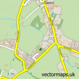
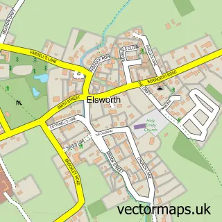
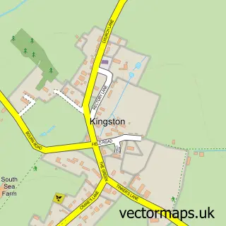
This Cambourne street map is a detailed vector street map covering a 750m x 750m area. Select a larger area to create and download your own vector street map of Cambourne.
The 750-metre map sample for Cambourne covers 257 mapped buildings and approximately 14.6 km of road detail, of which 29 named roads are named. The immediate area includes 1 school, 1 GP surgery, with 2 within 2 miles, 1 pub and 2 MOT stations within 2 miles. The wider area around Cambourne features 3 tourism points of interest, 2 food and drink venues and 2 hotels. To create a larger or custom map of Cambourne, the map builder lets you define your own coverage area and download editable SVG, PDF and PNG files.
Create a larger editable map of Cambourne
Choose any area you need and generate a high-quality vector map instantly. Perfect for print, planning, design, business and personal use.

This Cambourne street map in Cambridgeshire is available as downloadable SVG, PDF and PNG map files, or as a printed map for planning, business, display, education, local information and design work. You can also create a larger custom map area using the map selector.
What this Cambourne map sample shows
Cambourne lies within Cambourne Cp parish, part of Cambourne ward in the South Cambridgeshire District local authority area. The postcode geography for this area includes the CB postcode area, the CB23 postcode district and the CB23 6 postcode sector. Residents fall under the Nhs Cambridgeshire And Peterborough Integrated Care Board for NHS services.
Local features near Cambourne
Within 2 milesAmenities and services in and around Cambourne.
Administrative and postcode information for Cambourne
Cambourne lies within Cambourne Cp parish, part of Cambourne ward in the South Cambridgeshire District local authority area. The postcode geography for this area includes the CB postcode area, the CB23 postcode district and the CB23 6 postcode sector. Residents fall under the Nhs Cambridgeshire And Peterborough Integrated Care Board for NHS services.
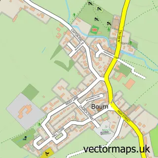
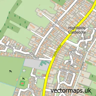
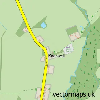
Nearby street map samples around Cambourne

More street maps in Cambridgeshire
750 metre map area coverage
Boundary, postcode and point of interest information for the 750m x 750m rectangle centred on this sample map.
Boundaries containing map centre
Constituency: St. Neots and Mid Cambridgeshire Co Const
County: Cambridgeshire County
District: South Cambridgeshire District
Icb: NHS Central East ICB
Parish: Cambourne CP
Police Force: cambridgeshire
Postcode District: CB23
Postcode Sector: CB23 6
Ward: Cambourne Ward
Nearby boundaries intersecting sample
Postcode Sector: CB23 4, CB23 5
Postcode coverage
POI category counts
Business Management Services: 7
Professional Services: 7
Home Health Care: 6
Business: 4
Employment Agencies: 4
Financial Service: 4
Pet Store: 4
Airport Shuttles: 3
Corporate Office: 3
Park: 3
Sample points of interest
- TaxAssist Accountants
- 8 Immortals Healing Arts
- Simex Aerospace
- E-Wave Green Airport Transfers
- e-Wave Green Airport Transfers
- e-Wave Green Airport Transfers
- Fiona Drummond
- East of England Ambulance Service Nhs Trust
- Chutney Joe
- Cambridge building society
- The Cambridge Building Society
- Salon Se7en
Create a larger editable map of Cambourne
This sample shows only a 750 metre area. To create a larger map of Cambourne, use our map builder to choose your own coverage area, add titles and download editable SVG, PDF and PNG files.
Create a custom map of Cambourne