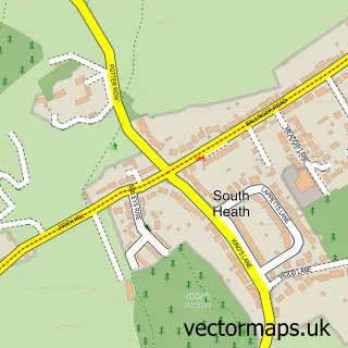
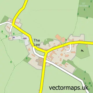
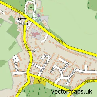
This Great Missenden street map is a detailed vector street map covering a 750m x 750m area. Select a larger area to create and download your own vector street map of Great Missenden.
The 750-metre map sample for Great Missenden covers 263 mapped buildings and approximately 22.8 km of road detail, of which 21 named roads are named. The immediate area includes 1 school, 1 railway station, 2 GP surgeries within 2 miles and 3 pubs among other local services. The wider area around Great Missenden features 5 tourism points of interest and 12 food and drink venues. To create a larger or custom map of Great Missenden, the map builder lets you define your own coverage area and download editable SVG, PDF and PNG files.
Create a larger editable map of Great Missenden
Choose any area you need and generate a high-quality vector map instantly. Perfect for print, planning, design, business and personal use.

This Great Missenden street map in Buckinghamshire is available as downloadable SVG, PDF and PNG map files, or as a printed map for planning, business, display, education, local information and design work. You can also create a larger custom map area using the map selector.
What this Great Missenden map sample shows
Great Missenden lies within Great Missenden Cp parish, part of Great Missenden ward in the Buckinghamshire local authority area. The postcode geography for this area includes the HP postcode area, the HP16 postcode district and the HP16 9 postcode sector. Residents fall under the Nhs Buckinghamshire, Oxfordshire And Berkshire West Integrated Care Board for NHS services.
Local features near Great Missenden
Within 2 milesAmenities and services in and around Great Missenden.
Administrative and postcode information for Great Missenden
The local authority covering Great Missenden is Buckinghamshire, within the county of Buckinghamshire. The settlement lies within Great Missenden ward and Great Missenden Cp civil parish. The HP16 postcode district and HP16 9 postcode sector serve the immediate area. NHS provision in the area is delivered through Buckinghamshire Healthcare Nhs Trust.
Nearby street map samples around Great Missenden

More street maps in Buckinghamshire
750 metre map area coverage
Boundary, postcode and point of interest information for the 750m x 750m rectangle centred on this sample map.
Boundaries containing map centre
Constituency: Mid Buckinghamshire Co Const
District: Buckinghamshire
Icb: NHS Thames Valley ICB
Parish: Great Missenden CP
Police Force: thames valley
Postcode District: HP16
Postcode Sector: HP16 9
Ward: The Missendens Ward
Nearby boundaries intersecting sample
Postcode Sector: HP16 0
Postcode coverage
POI category counts
Professional Services: 7
Flowers And Gifts Shop: 6
Real Estate Agent: 6
Cafe: 5
Advertising Agency: 3
Bakery: 3
Building Supply Store: 3
Pub: 3
Antique Store: 2
Art Gallery: 2
Sample points of interest
- EK Healing
- ABF Marketing
- Mi Pr
- Tompson Design
- Construction Materials Ltd.
- Barnardo's
- Straker Vintage
- Hawkins Eades Associates
- Carina Haslam Art
- One Church Street Gallery
- The Fremantle Trust
- The Cooperative Food Great Missenden
Create a larger editable map of Great Missenden
This sample shows only a 750 metre area. To create a larger map of Great Missenden, use our map builder to choose your own coverage area, add titles and download editable SVG, PDF and PNG files.
Create a custom map of Great Missenden