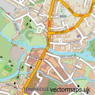
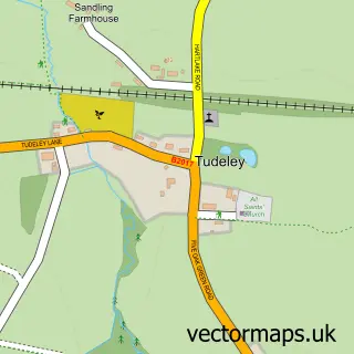
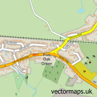
This Hadlow street map is a detailed vector street map covering a 750m x 750m area. Select a larger area to create and download your own vector street map of Hadlow.
The 750-metre map sample for Hadlow covers 436 mapped buildings and approximately 12.0 km of road detail, of which 27 named roads are named. The immediate area includes 1 school, 1 GP surgery and 2 pubs. The wider area around Hadlow features 1 tourism point of interest and 3 food and drink venues. To create a larger or custom map of Hadlow, the map builder lets you define your own coverage area and download editable SVG, PDF and PNG files.
Create a larger editable map of Hadlow
Choose any area you need and generate a high-quality vector map instantly. Perfect for print, planning, design, business and personal use.

This Hadlow street map in Kent is available as downloadable SVG, PDF and PNG map files, or as a printed map for planning, business, display, education, local information and design work. You can also create a larger custom map area using the map selector.
What this Hadlow map sample shows
Hadlow lies within Hadlow Cp parish, part of Hadlow And East Peckham ward in the Tonbridge And Malling District (B) local authority area. The postcode geography for this area includes the TN postcode area, the TN11 postcode district and the TN11 0 postcode sector. Residents fall under the Nhs Kent And Medway Integrated Care Board for NHS services.
Local features near Hadlow
Within 2 milesAmenities and services in and around Hadlow.
Administrative and postcode information for Hadlow
Hadlow lies within Hadlow Cp parish, part of Hadlow And East Peckham ward in the Tonbridge And Malling District (B) local authority area. The postcode geography for this area includes the TN postcode area, the TN11 postcode district and the TN11 0 postcode sector. Residents fall under the Nhs Kent And Medway Integrated Care Board for NHS services.
Nearby street map samples around Hadlow

More street maps in Kent
750 metre map area coverage
Boundary, postcode and point of interest information for the 750m x 750m rectangle centred on this sample map.
Boundaries containing map centre
Constituency: Tonbridge Co Const
County: Kent County
District: Tonbridge and Malling District (B)
Icb: NHS Kent and Medway ICB
Parish: Hadlow CP
Police Force: kent
Postcode District: TN11
Postcode Sector: TN11 0
Ward: Bourne Ward
Nearby boundaries intersecting sample
No additional intersecting boundaries found.
Postcode coverage
POI category counts
Bakery: 2
Beauty Salon: 2
Church Cathedral: 2
Dentist: 2
Education: 2
Fish And Chips Restaurant: 2
Flowers And Gifts Shop: 2
Furniture Store: 2
Gutter Service: 2
Post Office: 2
Sample points of interest
- St Mary's Hadlow
- Oriental Antiques UK - Asian Art Dealer and Appraiser
- MKA Architects
- Hadlow Marine Services
- Hadlow Village Bakery & Corporate/Event Catering
- Village Bakers
- Broadway Beauty
- My Face Place
- Marpaul Southern Ltd.
- I Am Your Pa
- Pyhän Marian kirkko
- St Mary's Church
Create a larger editable map of Hadlow
This sample shows only a 750 metre area. To create a larger map of Hadlow, use our map builder to choose your own coverage area, add titles and download editable SVG, PDF and PNG files.
Create a custom map of Hadlow