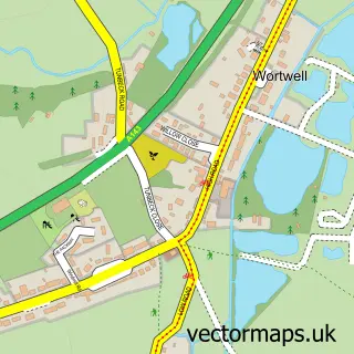
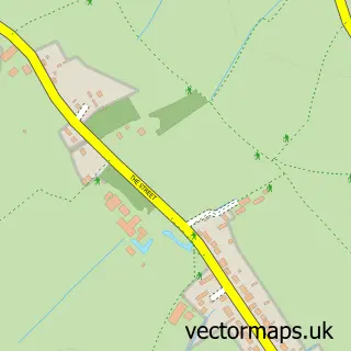
This Harleston street map is a detailed vector street map covering a 750m x 750m area. Select a larger area to create and download your own vector street map of Harleston.
The 750-metre map sample for Harleston covers 557 mapped buildings and approximately 23.5 km of road detail, of which 53 named roads are named. The immediate area includes 1 GP surgery, 1 pub and 3 MOT stations within 2 miles. The wider area around Harleston features 1 tourism point of interest, 13 food and drink venues and 5 hotels. To create a larger or custom map of Harleston, the map builder lets you define your own coverage area and download editable SVG, PDF and PNG files.
Create a larger editable map of Harleston
Choose any area you need and generate a high-quality vector map instantly. Perfect for print, planning, design, business and personal use.

This Harleston street map in Norfolk is available as downloadable SVG, PDF and PNG map files, or as a printed map for planning, business, display, education, local information and design work. You can also create a larger custom map area using the map selector.
What this Harleston map sample shows
Harleston lies within Redenhall With Harleston Cp parish, part of Harleston ward in the South Norfolk District local authority area. The postcode geography for this area includes the IP postcode area, the IP20 postcode district and the IP20 9 postcode sector. Residents fall under the Nhs Norfolk And Waveney Integrated Care Board for NHS services.
Local features near Harleston
Within 2 milesAmenities and services in and around Harleston.
Administrative and postcode information for Harleston
The local authority covering Harleston is South Norfolk District, within the county of Norfolk. The settlement lies within Harleston ward and Redenhall With Harleston Cp civil parish. The IP20 postcode district and IP20 9 postcode sector serve the immediate area. NHS provision in the area is delivered through Norfolk And Norwich University Hospitals Nhs Foundation Trust.
Nearby street map samples around Harleston

More street maps in Norfolk
750 metre map area coverage
Boundary, postcode and point of interest information for the 750m x 750m rectangle centred on this sample map.
Boundaries containing map centre
Constituency: Waveney Valley Co Const
County: Norfolk County
District: South Norfolk District
Icb: NHS Norfolk and Waveney ICB
Parish: Redenhall with Harleston CP
Police Force: norfolk
Postcode District: IP20
Postcode Sector: IP20 9
Ward: Harleston Ward
Nearby boundaries intersecting sample
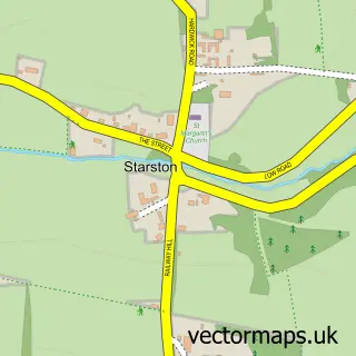
Parish: Starston CP
Ward: Beck Vale, Dickleburgh & Scole Ward
Postcode coverage
POI category counts
Beauty Salon: 11
Cafe: 9
Convenience Store: 6
Flowers And Gifts Shop: 5
Hotel: 5
Motorcycle Dealer: 5
Banks: 4
Courier And Delivery Services: 4
Funeral Services And Cemeteries: 4
Furniture Store: 4
Sample points of interest
- 10 Harleston
- Cornucopia at the Corn Xchange
- Harleston Cornucopia
- All Things Greener
- Fine Line Gallery
- Millhouse Pottery
- Town Living
- Harleston Cinema
- ThaiChai in Harleston
- Tripolitania Restaurant
- ATM (Post Office)
- East of England Co-Op Harleston
Create a larger editable map of Harleston
This sample shows only a 750 metre area. To create a larger map of Harleston, use our map builder to choose your own coverage area, add titles and download editable SVG, PDF and PNG files.
Create a custom map of Harleston