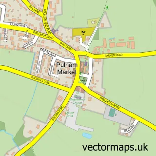
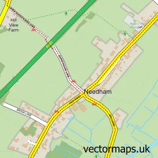
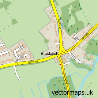
This Pulham St Mary street map is a detailed vector street map covering a 750m x 750m area. Select a larger area to create and download your own vector street map of Pulham St Mary.
The 750-metre map sample for Pulham St Mary covers 215 mapped buildings and approximately 11.0 km of road detail, of which 14 named roads are named. The immediate area includes 1 GP surgery within 2 miles and 1 MOT station, with 2 within 2 miles. The wider area around Pulham St Mary features 1 campsite within 2 miles. To create a larger or custom map of Pulham St Mary, the map builder lets you define your own coverage area and download editable SVG, PDF and PNG files.
Create a larger editable map of Pulham St Mary
Choose any area you need and generate a high-quality vector map instantly. Perfect for print, planning, design, business and personal use.

This Pulham St Mary street map in Norfolk is available as downloadable SVG, PDF and PNG map files, or as a printed map for planning, business, display, education, local information and design work. You can also create a larger custom map area using the map selector.
What this Pulham St Mary map sample shows
Pulham St Mary lies within Pulham St. Mary Cp parish, part of Beck Vale, Dickleburgh & Scole ward in the South Norfolk District local authority area. The postcode geography for this area includes the IP postcode area, the IP21 postcode district and the IP21 4 postcode sector. Residents fall under the Nhs Norfolk And Waveney Integrated Care Board for NHS services.
Local features near Pulham St Mary
Within 2 milesAmenities and services in and around Pulham St Mary.
Administrative and postcode information for Pulham St Mary
The local authority covering Pulham St Mary is South Norfolk District, within the county of Norfolk. The settlement lies within Beck Vale, Dickleburgh & Scole ward and Pulham St. Mary Cp civil parish. The IP21 postcode district and IP21 4 postcode sector serve the immediate area. NHS provision in the area is delivered through Norfolk And Norwich University Hospitals Nhs Foundation Trust.
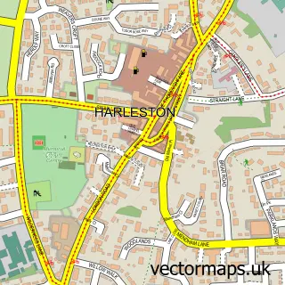
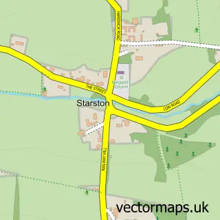
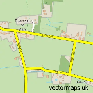
Nearby street map samples around Pulham St Mary

More street maps in Norfolk
750 metre map area coverage
Boundary, postcode and point of interest information for the 750m x 750m rectangle centred on this sample map.
Boundaries containing map centre
Constituency: Waveney Valley Co Const
County: Norfolk County
District: South Norfolk District
Icb: NHS Norfolk and Waveney ICB
Parish: Pulham St. Mary CP
Police Force: norfolk
Postcode District: IP21
Postcode Sector: IP21 4
Ward: Beck Vale, Dickleburgh & Scole Ward
Nearby boundaries intersecting sample
No additional intersecting boundaries found.
Postcode coverage
POI category counts
Convenience Store: 2
Anglican Church: 1
Automotive Repair: 1
Building Supply Store: 1
Community Center: 1
Education: 1
Hair Stylist: 1
Life Coach: 1
Medical Center: 1
Post Office: 1
Sample points of interest
- St Mary the Virgin, Pulham St Mary
- St Mary's Garage
- GB Services
- The Pennoyer Centre
- Bossyboots Convenience Store
- Londis
- Resource Initiatives
- Cara Hubbard Hair Artist
- RI Training
- The Priory Adult Group
- Post Office
- British Heart Foundation
Create a larger editable map of Pulham St Mary
This sample shows only a 750 metre area. To create a larger map of Pulham St Mary, use our map builder to choose your own coverage area, add titles and download editable SVG, PDF and PNG files.
Create a custom map of Pulham St Mary