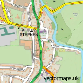
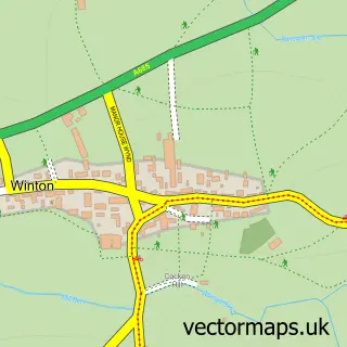
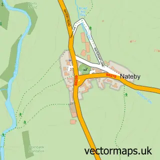
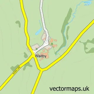
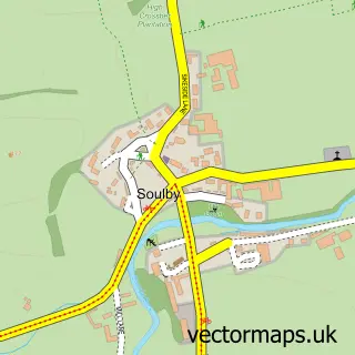
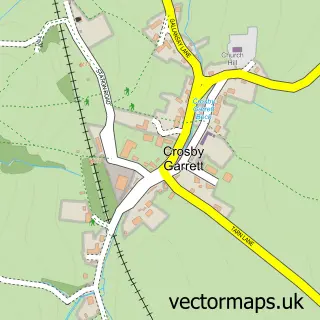
This Hartley street map is a detailed vector street map covering a 750m x 750m area. Select a larger area to create and download your own vector street map of Hartley.
The 750-metre map sample for Hartley covers 50 mapped buildings and approximately 8.3 km of road detail, of which 2 named roads are named. The immediate area includes 1 GP surgery within 2 miles and 1 MOT station, with 5 within 2 miles. The wider area around Hartley features 1 tourism point of interest and 1 hotel. To create a larger or custom map of Hartley, the map builder lets you define your own coverage area and download editable SVG, PDF and PNG files.
Create a larger editable map of Hartley
Choose any area you need and generate a high-quality vector map instantly. Perfect for print, planning, design, business and personal use.

This Hartley street map in Cumbria is available as downloadable SVG, PDF and PNG map files, or as a printed map for planning, business, display, education, local information and design work. You can also create a larger custom map area using the map selector.
What this Hartley map sample shows
Hartley lies within Hartley Cp parish, part of Kirkby Stephen ward in the Westmorland And Furness local authority area. The postcode geography for this area includes the CA postcode area, the CA17 postcode district and the CA17 4 postcode sector. Residents fall under the Nhs North East And North Cumbria Integrated Care Board for NHS services.
Local features near Hartley
Within 2 milesAmenities and services in and around Hartley.
Administrative and postcode information for Hartley
The local authority covering Hartley is Westmorland And Furness, within the county of Cumbria. The settlement lies within Kirkby Stephen ward and Hartley Cp civil parish. The CA17 postcode district and CA17 4 postcode sector serve the immediate area. NHS provision in the area is delivered through North Cumbria Integrated Care Nhs Foundation Trust.
Nearby street map samples around Hartley

More street maps in Cumbria
750 metre map area coverage
Boundary, postcode and point of interest information for the 750m x 750m rectangle centred on this sample map.
Boundaries containing map centre
Constituency: Westmorland and Lonsdale Co Const
District: Westmorland and Furness
Icb: NHS North East and North Cumbria ICB
Parish: Hartley CP
Police Force: cumbria
Postcode District: CA17
Postcode Sector: CA17 4
Ward: Kirkby Stephen and Tebay Ward
Nearby boundaries intersecting sample
Parish: Kirkby Stephen CP
Postcode coverage
POI category counts
Auto Detailing: 1
Automotive Services And Repair: 1
Business Manufacturing And Supply: 1
Food Delivery Service: 1
Hotel: 1
Landmark And Historical Building: 1
Pet Groomer: 1
Printing Services: 1
Professional Services: 1
Travel Agents: 1
Sample points of interest
- Veitchys Valeting and Detailing Services
- Veitchys Auto and electrics
- Hartley Quarries
- N & D Veitch Milk and More
- The Cottage Hartley
- Hartley, Cumbria
- Collar & Comb Cumbria Dog Grooming
- Cerberus Printing
- Lhoist UK
- Maximum Adventure
Create a larger editable map of Hartley
This sample shows only a 750 metre area. To create a larger map of Hartley, use our map builder to choose your own coverage area, add titles and download editable SVG, PDF and PNG files.
Create a custom map of Hartley