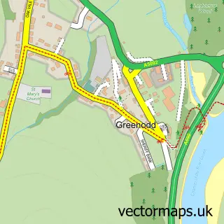
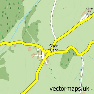
This Haverthwaite street map is a detailed vector street map covering a 750m x 750m area. Select a larger area to create and download your own vector street map of Haverthwaite.
The 750-metre map sample for Haverthwaite covers 54 mapped buildings and approximately 5.6 km of road detail. The immediate area includes 1 GP surgery within 2 miles and 1 MOT station within 2 miles. The wider area around Haverthwaite features 1 campsite within 2 miles. To create a larger or custom map of Haverthwaite, the map builder lets you define your own coverage area and download editable SVG, PDF and PNG files.
Create a larger editable map of Haverthwaite
Choose any area you need and generate a high-quality vector map instantly. Perfect for print, planning, design, business and personal use.

This Haverthwaite street map in Cumbria is available as downloadable SVG, PDF and PNG map files, or as a printed map for planning, business, display, education, local information and design work. You can also create a larger custom map area using the map selector.
What this Haverthwaite map sample shows
Haverthwaite lies within Haverthwaite Cp parish, part of Broughton & Coniston ward in the Westmorland And Furness local authority area. The postcode geography for this area includes the LA postcode area, the LA12 postcode district and the LA12 8 postcode sector. Residents fall under the Nhs Lancashire And South Cumbria Integrated Care Board for NHS services.
Local features near Haverthwaite
Within 2 milesAmenities and services in and around Haverthwaite.
Administrative and postcode information for Haverthwaite
Haverthwaite lies within Haverthwaite Cp parish, part of Broughton & Coniston ward in the Westmorland And Furness local authority area. The postcode geography for this area includes the LA postcode area, the LA12 postcode district and the LA12 8 postcode sector. Residents fall under the Nhs Lancashire And South Cumbria Integrated Care Board for NHS services.
Nearby street map samples around Haverthwaite

More street maps in Cumbria
750 metre map area coverage
Boundary, postcode and point of interest information for the 750m x 750m rectangle centred on this sample map.
Boundaries containing map centre
Constituency: Westmorland and Lonsdale Co Const
District: Westmorland and Furness
Icb: NHS Lancashire and South Cumbria ICB
Parish: Haverthwaite CP
Police Force: cumbria
Postcode District: LA12
Postcode Sector: LA12 8
Ward: Grange and Cartmel Ward
Nearby boundaries intersecting sample
No additional intersecting boundaries found.
Postcode coverage
POI category counts
Anglican Church: 1
Business Manufacturing And Supply: 1
Butcher Shop: 1
Hobby Shop: 1
Hvac Supplier: 1
It Service And Computer Repair: 1
Plumbing: 1
Retirement Home: 1
Sample points of interest
- St Anne's Parish Church Haverthwaite UK
- Playdale Playgrounds
- Sawrey Lakeland Grass fed Lamb
- Playdale Playgrounds Ltd.
- Oblyt Ltd.
- Oblyt
- Bespoke Heating
- Hollow Oak Nursing Home
Create a larger editable map of Haverthwaite
This sample shows only a 750 metre area. To create a larger map of Haverthwaite, use our map builder to choose your own coverage area, add titles and download editable SVG, PDF and PNG files.
Create a custom map of Haverthwaite