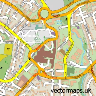
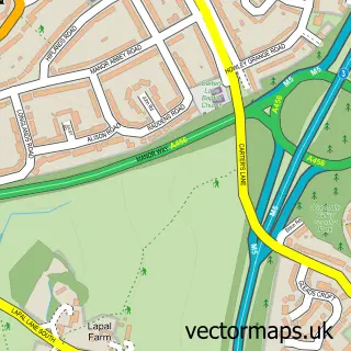
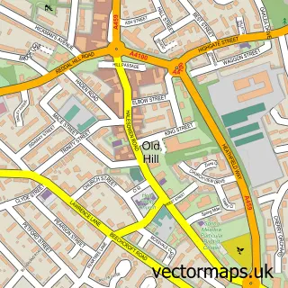
This Hawne street map is a detailed vector street map covering a 750m x 750m area. Select a larger area to create and download your own vector street map of Hawne.
The 750-metre map sample for Hawne covers 326 mapped buildings and approximately 45.3 km of road detail, of which 26 named roads are named. The immediate area includes 1 school, 12 GP surgeries within 2 miles, 2 pubs and 53 MOT stations within 2 miles. The wider area around Hawne features 2 food and drink venues. To create a larger or custom map of Hawne, the map builder lets you define your own coverage area and download editable SVG, PDF and PNG files.
Create a larger editable map of Hawne
Choose any area you need and generate a high-quality vector map instantly. Perfect for print, planning, design, business and personal use.

This Hawne street map in West Midlands is available as downloadable SVG, PDF and PNG map files, or as a printed map for planning, business, display, education, local information and design work. You can also create a larger custom map area using the map selector.
What this Hawne map sample shows
Hawne lies within Dudley District (B) parish, part of Halesowen South ward in the Dudley District (B) local authority area. The postcode geography for this area includes the B postcode area, the B63 postcode district and the B63 3 postcode sector. Residents fall under the Nhs Black Country Integrated Care Board for NHS services.
Local features near Hawne
Within 2 milesAmenities and services in and around Hawne.
Administrative and postcode information for Hawne
Hawne lies within Dudley District (B) parish, part of Halesowen South ward in the Dudley District (B) local authority area. The postcode geography for this area includes the B postcode area, the B63 postcode district and the B63 3 postcode sector. Residents fall under the Nhs Black Country Integrated Care Board for NHS services.
Nearby street map samples around Hawne


More street maps in West Midlands
750 metre map area coverage
Boundary, postcode and point of interest information for the 750m x 750m rectangle centred on this sample map.
Boundaries containing map centre
Constituency: Halesowen Boro Const
District: Dudley District (B)
Icb: NHS Black Country ICB
Police Force: west midlands
Postcode District: B63
Postcode Sector: B63 3
Ward: Belle Vale Ward
Nearby boundaries intersecting sample
No additional intersecting boundaries found.
Postcode coverage
POI category counts
Retail: 5
Building Supply Store: 3
Business Manufacturing And Supply: 3
Dance School: 2
Hair Salon: 2
Music School: 2
Plumbing: 2
Pub: 2
Tree Services: 2
Air Duct Cleaning Service: 1
Sample points of interest
- Deduct Ltd.
- Merry Brush Face and Body Art
- Bagged Performance
- Aalco
- Midland Cake Company
- The Crafty Boutique
- Digby Stone
- R S Plumbing & Heating
- West Midlands Window Cleaners
- Second City Leisure Ltd
- Solon Systems Ltd
- Sponmech Safety Systems
Create a larger editable map of Hawne
This sample shows only a 750 metre area. To create a larger map of Hawne, use our map builder to choose your own coverage area, add titles and download editable SVG, PDF and PNG files.
Create a custom map of Hawne