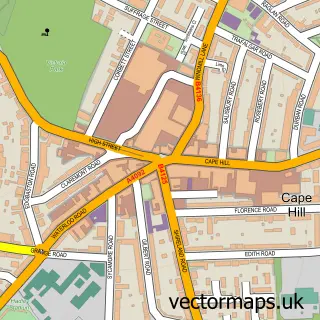
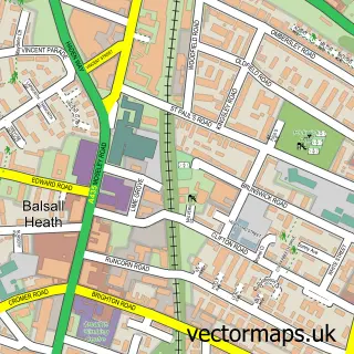
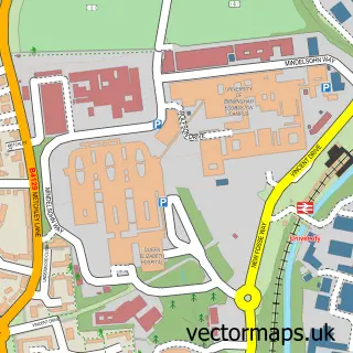
This Birmingham street map is a detailed vector street map covering a 750m x 750m area. Select a larger area to create and download your own vector street map of Birmingham.
The 750-metre map sample for Birmingham covers 100 mapped buildings and approximately 46.8 km of road detail, of which 51 named roads are named. The immediate area includes 1 school, 3 railway stations, 38 GP surgeries within 2 miles and 38 pubs among other local services. The wider area around Birmingham features 31 tourism points of interest, 141 food and drink venues and 29 hotels. To create a larger or custom map of Birmingham, the map builder lets you define your own coverage area and download editable SVG, PDF and PNG files.
Create a larger editable map of Birmingham
Choose any area you need and generate a high-quality vector map instantly. Perfect for print, planning, design, business and personal use.

This Birmingham street map in West Midlands is available as downloadable SVG, PDF and PNG map files, or as a printed map for planning, business, display, education, local information and design work. You can also create a larger custom map area using the map selector.
What this Birmingham map sample shows
Birmingham lies within Birmingham District (B) parish, part of Edgbaston ward in the Birmingham District (B) local authority area. The postcode geography for this area includes the B postcode area, the B15 postcode district and the B15 2 postcode sector. Residents fall under the Nhs Birmingham And Solihull Integrated Care Board for NHS services.
Local features near Birmingham
Within 2 milesAmenities and services in and around Birmingham.
Administrative and postcode information for Birmingham
Birmingham lies within Birmingham District (B) parish, part of Edgbaston ward in the Birmingham District (B) local authority area. The postcode geography for this area includes the B postcode area, the B15 postcode district and the B15 2 postcode sector. Residents fall under the Nhs Birmingham And Solihull Integrated Care Board for NHS services.
Nearby street map samples around Birmingham
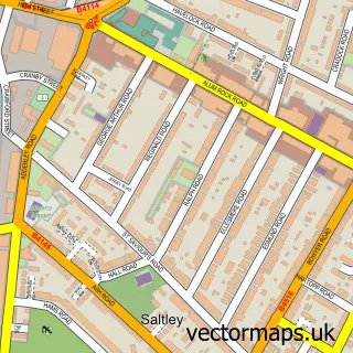
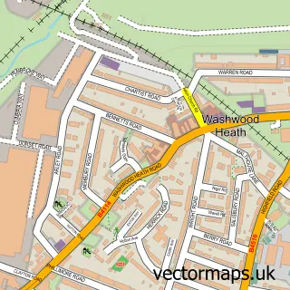
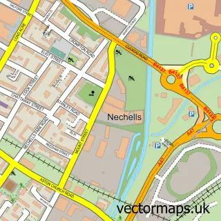
More street maps in West Midlands
750 metre map area coverage
Boundary, postcode and point of interest information for the 750m x 750m rectangle centred on this sample map.
Boundaries containing map centre
Constituency: Birmingham Ladywood Boro Const
District: Birmingham District (B)
Icb: NHS Birmingham and Solihull ICB
Police Force: west midlands
Postcode District: B3
Postcode Sector: B3 3
Ward: Ladywood Ward
Nearby boundaries intersecting sample
Postcode District: B1, B2, B4, B5
Postcode Sector: B1 1, B1 2, B2 4, B2 5, B3 1, B3 2
Ward: Soho & Jewellery Quarter Ward
Postcode coverage
POI category counts
Employment Agencies: 91
Professional Services: 89
Restaurant: 47
Corporate Office: 45
Clothing Store: 40
Coffee Shop: 39
Pub: 38
Bar: 35
Real Estate Agent: 35
Advertising Agency: 31
Sample points of interest
- BPAS Birmingham Central
- Malmaison Birmingham
- Student Roost
- A to Z Finance Solutions
- Accounts Hub Ltd
- Azets - Accountants & Business Advisors
- Bache Samuels
- Bishop Fleming
- Calculated Accountants
- Cooper Parry
- Dains Accountants
- Dains Accountants
Create a larger editable map of Birmingham
This sample shows only a 750 metre area. To create a larger map of Birmingham, use our map builder to choose your own coverage area, add titles and download editable SVG, PDF and PNG files.
Create a custom map of Birmingham