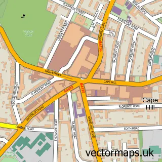
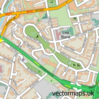
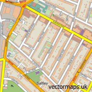
This Sparkbrook street map is a detailed vector street map covering a 750m x 750m area. Select a larger area to create and download your own vector street map of Sparkbrook.
The 750-metre map sample for Sparkbrook covers 342 mapped buildings and approximately 41.9 km of road detail, of which 48 named roads are named. The immediate area includes 3 schools, 2 GP surgeries, with 35 within 2 miles, 1 pub and 6 MOT stations, with 95 within 2 miles. The wider area around Sparkbrook features 2 tourism points of interest, 11 food and drink venues and 1 hotel. To create a larger or custom map of Sparkbrook, the map builder lets you define your own coverage area and download editable SVG, PDF and PNG files.
Create a larger editable map of Sparkbrook
Choose any area you need and generate a high-quality vector map instantly. Perfect for print, planning, design, business and personal use.

This Sparkbrook street map in West Midlands is available as downloadable SVG, PDF and PNG map files, or as a printed map for planning, business, display, education, local information and design work. You can also create a larger custom map area using the map selector.
What this Sparkbrook map sample shows
Sparkbrook lies within Birmingham District (B) parish, part of Moseley ward in the Birmingham District (B) local authority area. The postcode geography for this area includes the B postcode area, the B13 postcode district and the B13 9 postcode sector. Residents fall under the Nhs Birmingham And Solihull Integrated Care Board for NHS services.
Local features near Sparkbrook
Within 2 milesAmenities and services in and around Sparkbrook.
Administrative and postcode information for Sparkbrook
Sparkbrook lies within Birmingham District (B) parish, part of Moseley ward in the Birmingham District (B) local authority area. The postcode geography for this area includes the B postcode area, the B13 postcode district and the B13 9 postcode sector. Residents fall under the Nhs Birmingham And Solihull Integrated Care Board for NHS services.
Nearby street map samples around Sparkbrook

More street maps in West Midlands
750 metre map area coverage
Boundary, postcode and point of interest information for the 750m x 750m rectangle centred on this sample map.
Boundaries containing map centre
Constituency: Birmingham Hall Green and Moseley Boro Const
District: Birmingham District (B)
Icb: NHS Birmingham and Solihull ICB
Police Force: west midlands
Postcode District: B11
Postcode Sector: B11 1
Ward: Sparkbrook & Balsall Heath East Ward
Nearby boundaries intersecting sample
Constituency: Birmingham Ladywood Boro Const
Postcode District: B12
Postcode Sector: B12 0, B12 8
Postcode coverage
POI category counts
Automotive Repair: 13
Retail: 9
Professional Services: 7
Convenience Store: 5
Financial Service: 5
Fast Food Restaurant: 4
Restaurant: 4
Shopping: 4
Advertising Agency: 3
Barber: 3
Sample points of interest
- KIKIT Drugs Project
- Good Design Company
- Stylo Print
- WebFabricant
- St Agatha
- C T R
- Kitchen Appliances Ltd
- Soul City Arts
- City Service Station, Sparkhill
- Payzone
- A F G Body Work
- The detailing company
Create a larger editable map of Sparkbrook
This sample shows only a 750 metre area. To create a larger map of Sparkbrook, use our map builder to choose your own coverage area, add titles and download editable SVG, PDF and PNG files.
Create a custom map of Sparkbrook