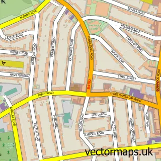
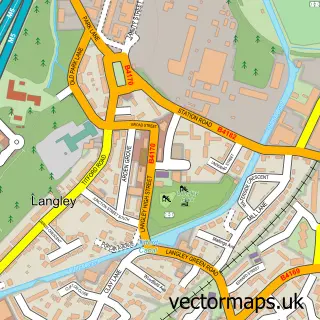
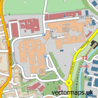
This Cape Hill street map is a detailed vector street map covering a 750m x 750m area. Select a larger area to create and download your own vector street map of Cape Hill.
The 750-metre map sample for Cape Hill covers 323 mapped buildings and approximately 34.4 km of road detail, of which 33 named roads are named. The immediate area includes 2 primary schools and 1 secondary school, 1 GP surgery, with 33 within 2 miles, 2 pubs and 51 MOT stations within 2 miles. The wider area around Cape Hill features 11 food and drink venues. To create a larger or custom map of Cape Hill, the map builder lets you define your own coverage area and download editable SVG, PDF and PNG files.
Create a larger editable map of Cape Hill
Choose any area you need and generate a high-quality vector map instantly. Perfect for print, planning, design, business and personal use.

This Cape Hill street map in West Midlands is available as downloadable SVG, PDF and PNG map files, or as a printed map for planning, business, display, education, local information and design work. You can also create a larger custom map area using the map selector.
What this Cape Hill map sample shows
Cape Hill lies within Sandwell District (B) parish, part of Abbey ward in the Sandwell District (B) local authority area. The postcode geography for this area includes the B postcode area, the B66 postcode district and the B66 4 postcode sector. Residents fall under the Nhs Black Country Integrated Care Board for NHS services.
Local features near Cape Hill
Within 2 milesAmenities and services in and around Cape Hill.
Administrative and postcode information for Cape Hill
Cape Hill lies within Sandwell District (B) parish, part of Abbey ward in the Sandwell District (B) local authority area. The postcode geography for this area includes the B postcode area, the B66 postcode district and the B66 4 postcode sector. Residents fall under the Nhs Black Country Integrated Care Board for NHS services.
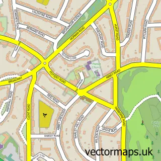
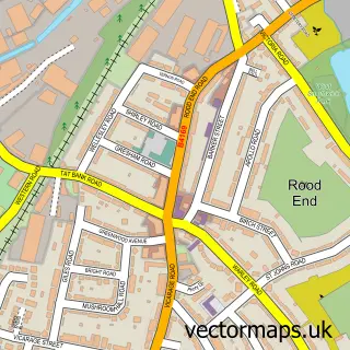
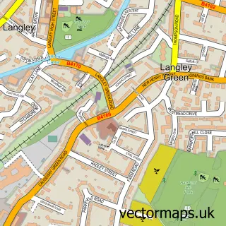
Nearby street map samples around Cape Hill

More street maps in West Midlands
750 metre map area coverage
Boundary, postcode and point of interest information for the 750m x 750m rectangle centred on this sample map.
Boundaries containing map centre
Constituency: Smethwick Boro Const
District: Sandwell District (B)
Icb: NHS Black Country ICB
Police Force: west midlands
Postcode District: B66
Postcode Sector: B66 4
Ward: Soho and Victoria Ward
Nearby boundaries intersecting sample
Postcode Sector: B66 3
Postcode coverage
POI category counts
Beauty Salon: 15
Fast Food Restaurant: 13
Clothing Store: 11
Grocery Store: 9
Supermarket: 9
Mobile Phone Store: 8
Bakery: 6
Restaurant: 6
Church Cathedral: 5
Barber: 4
Sample points of interest
- The Ron Davis Centre
- ONYE Restaurant
- Obama1 Restaurant and Bar
- ANAS appliances
- Masala Bazaar
- Masala Bazaar - Cape Hill Retail Centre, Birmingham
- ATM (Post Office)
- Atm
- Liberty Mortgage & Financial Services
- Morris Upholstery
- Aero Trade Fashions
- Cake Box Capehill
Create a larger editable map of Cape Hill
This sample shows only a 750 metre area. To create a larger map of Cape Hill, use our map builder to choose your own coverage area, add titles and download editable SVG, PDF and PNG files.
Create a custom map of Cape Hill