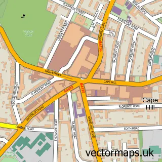
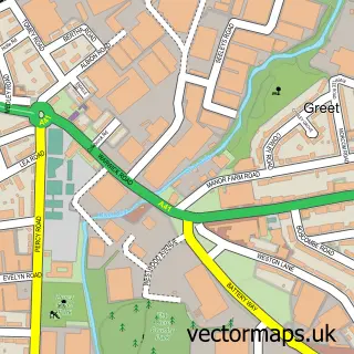
This Highgate street map is a detailed vector street map covering a 750m x 750m area. Select a larger area to create and download your own vector street map of Highgate.
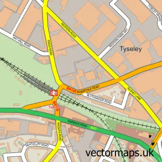
The 750-metre map sample for Highgate covers 191 mapped buildings and approximately 41.0 km of road detail, of which 48 named roads are named. The immediate area includes 2 primary schools and 1 secondary school, 2 GP surgeries, with 36 within 2 miles, 1 pub and 2 MOT stations, with 90 within 2 miles. The wider area around Highgate features 1 tourism point of interest, 5 food and drink venues and 1 hotel. To create a larger or custom map of Highgate, the map builder lets you define your own coverage area and download editable SVG, PDF and PNG files.
Create a larger editable map of Highgate
Choose any area you need and generate a high-quality vector map instantly. Perfect for print, planning, design, business and personal use.

This Highgate street map in West Midlands is available as downloadable SVG, PDF and PNG map files, or as a printed map for planning, business, display, education, local information and design work. You can also create a larger custom map area using the map selector.
What this Highgate map sample shows
Highgate lies within Birmingham District (B) parish, part of Edgbaston ward in the Birmingham District (B) local authority area. The postcode geography for this area includes the B postcode area, the B15 postcode district and the B15 2 postcode sector. Residents fall under the Nhs Birmingham And Solihull Integrated Care Board for NHS services.
Local features near Highgate
Within 2 milesAmenities and services in and around Highgate.
Administrative and postcode information for Highgate
The local authority covering Highgate is Birmingham District (B), within the county of West Midlands. The settlement lies within Edgbaston ward and Birmingham District (B) civil parish. The B15 postcode district and B15 2 postcode sector serve the immediate area. NHS provision in the area is delivered through University Hospitals Birmingham Nhs Foundation Trust.
Nearby street map samples around Highgate

More street maps in West Midlands
750 metre map area coverage
Boundary, postcode and point of interest information for the 750m x 750m rectangle centred on this sample map.
Boundaries containing map centre
Constituency: Birmingham Ladywood Boro Const
District: Birmingham District (B)
Icb: NHS Birmingham and Solihull ICB
Police Force: west midlands
Postcode District: B12
Postcode Sector: B12 0
Ward: Bordesley & Highgate Ward
Nearby boundaries intersecting sample
Constituency: Birmingham Hall Green and Moseley Boro Const
Postcode District: B11, B5
Postcode Sector: B11 1, B12 9, B5 7
Ward: Balsall Heath West Ward, Sparkbrook & Balsall Heath East Ward
Postcode coverage
POI category counts
Automotive Repair: 7
Church Cathedral: 5
Professional Services: 5
Auto Electrical Repair: 4
Education: 4
Electronics: 4
Engineering Services: 4
Accountant: 3
Anglican Church: 3
Butcher Shop: 3
Sample points of interest
- Amstor Accountants Ltd.
- Midland Accountants
- Reliance Accounting Solutions
- Birmingham First Aid Courses
- Darul Ilm Birmingham
- Ambulance & Mobility Transport
- St Alban the Martyr
- St Alban's Church
- St Alban's Church
- Friends Institute Life Study Group
- Extreme Boys Toys
- Highgate Market (Protected), Horton Square
Create a larger editable map of Highgate
This sample shows only a 750 metre area. To create a larger map of Highgate, use our map builder to choose your own coverage area, add titles and download editable SVG, PDF and PNG files.
Create a custom map of Highgate