Vector Maps logo
Home Why it works Popular maps Districts Samples Customizer Create Your Map
VectorMaps.uk
Home Popular maps Districts Samples Customizer Create Your Map Privacy Disclaimer
Home / UK Maps / West Midlands / Saltley Map

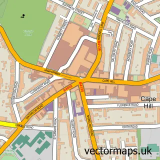
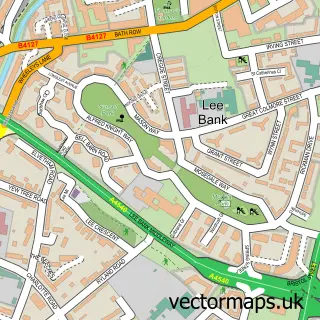
This Saltley street map is a detailed vector street map covering a 750m x 750m area. Select a larger area to create and download your own vector street map of Saltley.

Saltley is a village in West Midlands, in the West Midlands of England. Historically, the area formed part of Warwickshire. The settlement falls within the Birmingham, Ladywood parliamentary constituency. It is served by the B6 postcode district, with B6

The 750-metre map sample for Saltley covers 468 mapped buildings and approximately 37.4 km of road detail, of which 40 named roads are named. The immediate area includes 2 schools, 5 GP surgeries, with 34 within 2 miles and 96 MOT stations within 2 miles. The wider area around Saltley features 1 tourism point of interest and 9 food and drink venues. To create a larger or custom map of Saltley, the map builder lets you define your own coverage area and download editable SVG, PDF and PNG files.

468Buildings
37.35 kmRoads
40Named roads
51,693Residents within 2 miles
Create your own

Create a larger editable map of Saltley

Choose any area you need and generate a high-quality vector map instantly. Perfect for print, planning, design, business and personal use.

Choose any location
Editable SVG files
Any size up to A0
PDF, PNG & more
Instant download
High quality guaranteed
Create My Custom Map
Secure, private & no credit card required
Saltley Vector Street Map
750m Sample
Saltley vector street map sample showing roads, buildings and local features in a 750 metre preview area
Buy Saltley Map Print from £12.95 Buy Saltley Digital Map from £6

This Saltley street map in West Midlands is available as downloadable SVG, PDF and PNG map files, or as a printed map for planning, business, display, education, local information and design work. You can also create a larger custom map area using the map selector.

What this Saltley map sample shows

Saltley lies within Birmingham District (B) parish, part of Nechells ward in the Birmingham District (B) local authority area. The postcode geography for this area includes the B postcode area, the B6 postcode district and the B6 5 postcode sector. Residents fall under the Nhs Birmingham And Solihull Integrated Care Board for NHS services.

Local features near Saltley

Within 2 miles

Amenities and services in and around Saltley.

2 Schools
5 GP surgeries 34 within 2 miles
96 MOT stations within 2 miles
1 Tourism & leisure
9 Food & drink
11 Healthcare POIs
2 Vehicle services

Counts are approximate and based on publicly available data.

Administrative and postcode information for Saltley

Saltley lies within Birmingham District (B) parish, part of Nechells ward in the Birmingham District (B) local authority area. The postcode geography for this area includes the B postcode area, the B6 postcode district and the B6 5 postcode sector. Residents fall under the Nhs Birmingham And Solihull Integrated Care Board for NHS services.

Parish BIRMINGHAM DISTRICT (B)
Ward Nechells
District / local authority Birmingham District (B)
County West Midlands
Historic county Warwickshire
Postcode district B6
Postcode sector B6 5
Parliamentary constituency Birmingham, Ladywood
Region West Midlands
Country England

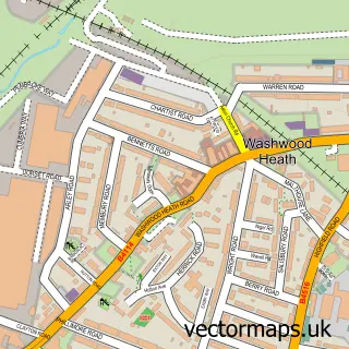
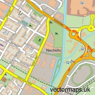
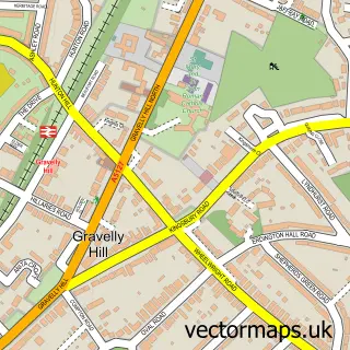
Nearby street map samples around Saltley

Street map sample of Cape Hill, West Midlands Cape Hill Town - West Midlands - 4.3 miles Street map sample of Birmingham, West Midlands Birmingham City - West Midlands - 2.0 miles Street map sample of Washwood Heath, West Midlands Washwood Heath Village - West Midlands - 0.5 miles Street map sample of Nechells, West Midlands Nechells Village - West Midlands - 0.9 miles Street map sample of Gravelly Hill, West Midlands Gravelly Hill Village - West Midlands - 1.8 miles Street map sample of Sparkbrook, West Midlands Sparkbrook Village - West Midlands - 1.9 miles Street map sample of Highgate, West Midlands Highgate Village - West Midlands - 2.0 miles Street map sample of Hay Mills, West Midlands Hay Mills Village - West Midlands - 2.2 miles Street map sample of Greet, West Midlands Greet Village - West Midlands - 2.4 miles Street map sample of Park Central, West Midlands Park Central Village - West Midlands - 2.4 miles

More street maps in West Midlands

Street map sample of Washwood Heath, West Midlands Washwood Heath Village - 0.5 miles Street map sample of Nechells, West Midlands Nechells Village - 0.9 miles Street map sample of Gravelly Hill, West Midlands Gravelly Hill Village - 1.8 miles Street map sample of Sparkbrook, West Midlands Sparkbrook Village - 1.9 miles Street map sample of Highgate, West Midlands Highgate Village - 2.0 miles

750 metre map area coverage

Boundary, postcode and point of interest information for the 750m x 750m rectangle centred on this sample map.

Boundaries containing map centre

Constituency: Birmingham Ladywood Boro Const

District: Birmingham District (B)

Icb: NHS Birmingham and Solihull ICB

Police Force: west midlands

Postcode District: B8

Postcode Sector: B8 1

Ward: Alum Rock Ward

Nearby boundaries intersecting sample

Postcode Sector: B8 3

Postcode coverage

B8 B8 1 B8 3

POI category counts

Clothing Store: 22

Jewelry Store: 9

Doctor: 8

Womens Clothing Store: 7

Fast Food Restaurant: 6

Restaurant: 6

Charity Organization: 5

Fabric Store: 5

Mobile Phone Store: 5

Professional Services: 5

Sample points of interest

  • The Jet Shop Adult Education
  • La Burger American Restaurant
  • St Saviour, Saltley Anglican Church
  • Islamic Frames Online Arts And Crafts
  • Movietone Arts And Entertainment
  • Tepu Sultan Resturant Asian Restaurant
  • ATM (Post Office) Atms
  • Go Waste UK Ltd. Audiovisual Equipment Rental
  • AK Motors Auto Body Shop
  • J Bodywork Auto Body Shop
  • EMC Motorsport Automotive
  • B D Car Parts Automotive Parts And Accessories

Create a larger editable map of Saltley

This sample shows only a 750 metre area. To create a larger map of Saltley, use our map builder to choose your own coverage area, add titles and download editable SVG, PDF and PNG files.

Create a custom map of Saltley

Phone 01751 473136 | Copyright Vectormaps.uk 2026

Samples Customizer Privacy Disclaimer
Saltley Vector Street Map
Saltley enlarged street map sample showing a 750 metre preview area