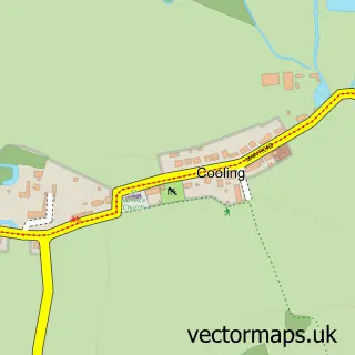
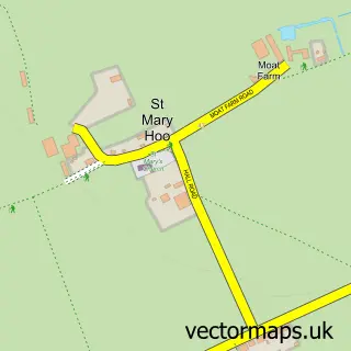
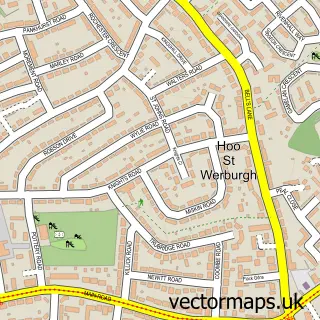
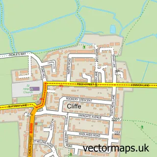
This High Halstow street map is a detailed vector street map covering a 750m x 750m area. Select a larger area to create and download your own vector street map of High Halstow.
The 750-metre map sample for High Halstow covers 254 mapped buildings and approximately 9.1 km of road detail, of which 18 named roads are named. The immediate area includes 1 school, 2 GP surgeries within 2 miles, 1 pub and 1 MOT station within 2 miles. The wider area around High Halstow features 1 food and drink venue. To create a larger or custom map of High Halstow, the map builder lets you define your own coverage area and download editable SVG, PDF and PNG files.
Create a larger editable map of High Halstow
Choose any area you need and generate a high-quality vector map instantly. Perfect for print, planning, design, business and personal use.

This High Halstow street map in Kent is available as downloadable SVG, PDF and PNG map files, or as a printed map for planning, business, display, education, local information and design work. You can also create a larger custom map area using the map selector.
What this High Halstow map sample shows
High Halstow lies within High Halstow Cp parish, part of Peninsula ward in the Medway (B) local authority area. The postcode geography for this area includes the ME postcode area, the ME3 postcode district and the ME3 8 postcode sector. Residents fall under the Nhs Kent And Medway Integrated Care Board for NHS services.
Local features near High Halstow
Within 2 milesAmenities and services in and around High Halstow.
Administrative and postcode information for High Halstow
The local authority covering High Halstow is Medway (B), within the county of Kent. The settlement lies within Peninsula ward and High Halstow Cp civil parish. The ME3 postcode district and ME3 8 postcode sector serve the immediate area. NHS provision in the area is delivered through Medway Nhs Foundation Trust.
Nearby street map samples around High Halstow

More street maps in Kent
750 metre map area coverage
Boundary, postcode and point of interest information for the 750m x 750m rectangle centred on this sample map.
Boundaries containing map centre
Constituency: Rochester and Strood Co Const
District: Medway (B)
Icb: NHS Kent and Medway ICB
Parish: High Halstow CP
Police Force: kent
Postcode District: ME3
Postcode Sector: ME3 8
Ward: Hoo St. Werburgh & High Halstow Ward
Nearby boundaries intersecting sample
No additional intersecting boundaries found.
Postcode coverage
POI category counts
Community Center: 2
Construction Services: 2
Elementary School: 2
Kids Recreation And Party: 2
Active Life: 1
Alternative Medicine: 1
Anglican Church: 1
Building Contractor: 1
Building Supply Store: 1
Carpenter: 1
Sample points of interest
- Tai Chi at Tree
- Wanda Wright
- High Halstow - St Margaret's
- Paul Hughes Double Glazing
- Raigins Cleaning Services
- Fenners Carpentry
- Healthy Living Centre Dartford
- St Margaret's Church
- High Halstow Village Hall
- Tree Estate Community Centre
- Concept Infrastructure
- Fenners Construction
Create a larger editable map of High Halstow
This sample shows only a 750 metre area. To create a larger map of High Halstow, use our map builder to choose your own coverage area, add titles and download editable SVG, PDF and PNG files.
Create a custom map of High Halstow