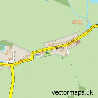
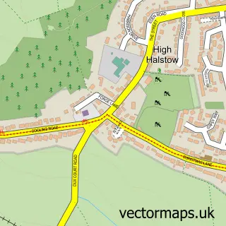
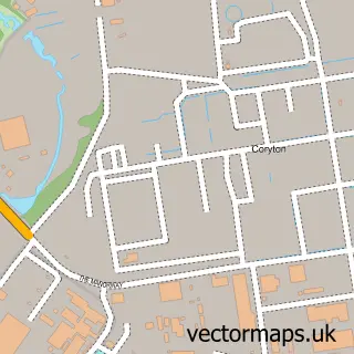
This Cliffe street map is a detailed vector street map covering a 750m x 750m area. Select a larger area to create and download your own vector street map of Cliffe.
The 750-metre map sample for Cliffe covers 303 mapped buildings and approximately 13.4 km of road detail, of which 24 named roads are named. The immediate area includes 1 GP surgery within 2 miles, 1 pub and 1 MOT station within 2 miles. The wider area around Cliffe features 1 food and drink venue. To create a larger or custom map of Cliffe, the map builder lets you define your own coverage area and download editable SVG, PDF and PNG files.
Create a larger editable map of Cliffe
Choose any area you need and generate a high-quality vector map instantly. Perfect for print, planning, design, business and personal use.

This Cliffe street map in Kent is available as downloadable SVG, PDF and PNG map files, or as a printed map for planning, business, display, education, local information and design work. You can also create a larger custom map area using the map selector.
What this Cliffe map sample shows
Cliffe lies within Cliffe And Cliffe Woods Cp parish, part of Strood Rural ward in the Medway (B) local authority area. The postcode geography for this area includes the ME postcode area, the ME3 postcode district and the ME3 7 postcode sector. Residents fall under the Nhs Kent And Medway Integrated Care Board for NHS services.
Local features near Cliffe
Within 2 milesAmenities and services in and around Cliffe.
Administrative and postcode information for Cliffe
Cliffe lies within Cliffe And Cliffe Woods Cp parish, part of Strood Rural ward in the Medway (B) local authority area. The postcode geography for this area includes the ME postcode area, the ME3 postcode district and the ME3 7 postcode sector. Residents fall under the Nhs Kent And Medway Integrated Care Board for NHS services.
Nearby street map samples around Cliffe

More street maps in Kent
750 metre map area coverage
Boundary, postcode and point of interest information for the 750m x 750m rectangle centred on this sample map.
Boundaries containing map centre
Constituency: Rochester and Strood Co Const
District: Medway (B)
Icb: NHS Kent and Medway ICB
Parish: Cliffe and Cliffe Woods CP
Police Force: kent
Postcode District: ME3
Postcode Sector: ME3 7
Ward: Strood Rural Ward
Nearby boundaries intersecting sample
No additional intersecting boundaries found.
Postcode coverage
POI category counts
Beauty Salon: 3
Bar: 2
Scout Hall: 2
Anglican Church: 1
Architecture: 1
Building Contractor: 1
Building Supply Store: 1
Business Manufacturing And Supply: 1
Car Wash: 1
Child Care And Day Care: 1
Sample points of interest
- St Helen's Church
- St. Helen C of E Church
- The Evening Star
- The Six Bells
- Forever Flawless
- Pulse Permanent Makeup
- The Secret Spa
- Riverview Blinds
- Fleet Scaffolding
- Kodit Security UK LTD
- Williams’ Detailing
- Michelle Childminding Services
Create a larger editable map of Cliffe
This sample shows only a 750 metre area. To create a larger map of Cliffe, use our map builder to choose your own coverage area, add titles and download editable SVG, PDF and PNG files.
Create a custom map of Cliffe