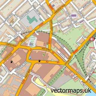
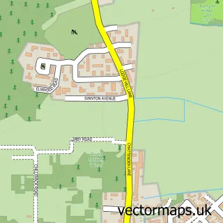
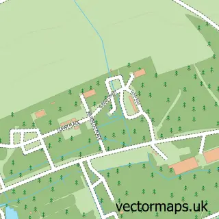
This Wainscott street map is a detailed vector street map covering a 750m x 750m area. Select a larger area to create and download your own vector street map of Wainscott.
The 750-metre map sample for Wainscott covers 483 mapped buildings and approximately 24.5 km of road detail, of which 40 named roads are named. The immediate area includes 1 school, 4 GP surgeries within 2 miles, 3 pubs and 19 MOT stations within 2 miles. The wider area around Wainscott features 3 tourism points of interest and 3 food and drink venues. To create a larger or custom map of Wainscott, the map builder lets you define your own coverage area and download editable SVG, PDF and PNG files.
Create a larger editable map of Wainscott
Choose any area you need and generate a high-quality vector map instantly. Perfect for print, planning, design, business and personal use.

This Wainscott street map in Kent is available as downloadable SVG, PDF and PNG map files, or as a printed map for planning, business, display, education, local information and design work. You can also create a larger custom map area using the map selector.
What this Wainscott map sample shows
Wainscott lies within Frindsbury Extra Cp parish, part of Strood Rural ward in the Medway (B) local authority area. The postcode geography for this area includes the ME postcode area, the ME2 postcode district and the ME2 4 postcode sector. Residents fall under the Nhs Kent And Medway Integrated Care Board for NHS services.
Local features near Wainscott
Within 2 milesAmenities and services in and around Wainscott.
Administrative and postcode information for Wainscott
Wainscott lies within Frindsbury Extra Cp parish, part of Strood Rural ward in the Medway (B) local authority area. The postcode geography for this area includes the ME postcode area, the ME2 postcode district and the ME2 4 postcode sector. Residents fall under the Nhs Kent And Medway Integrated Care Board for NHS services.
Nearby street map samples around Wainscott

More street maps in Kent
750 metre map area coverage
Boundary, postcode and point of interest information for the 750m x 750m rectangle centred on this sample map.
Boundaries containing map centre
Constituency: Rochester and Strood Co Const
District: Medway (B)
Icb: NHS Kent and Medway ICB
Parish: Frindsbury Extra CP
Police Force: kent
Postcode District: ME2
Postcode Sector: ME2 4
Ward: Strood Rural Ward
Nearby boundaries intersecting sample
Postcode District: ME3
Postcode Sector: ME3 8
Postcode coverage
POI category counts
Convenience Store: 3
Flowers And Gifts Shop: 3
Pub: 3
Beauty Salon: 2
Books Mags Music And Video: 2
Church Cathedral: 2
Doctor: 2
Park: 2
Professional Services: 2
Youth Organizations: 2
Sample points of interest
- Frindsbury House
- The Cooperative Food Wainscott - Wainscott Road, Wainscott
- NP Autos
- Pheonix Plates
- Tune at Home
- Wainscott Barber Shop
- Beauty Spot
- Rianna Kaya Semi Permanent Make Up
- Post Office-Wainscott Road
- Wainscott Road Post Office
- Traditions Wedding Cars
- Your Virtual EA
Create a larger editable map of Wainscott
This sample shows only a 750 metre area. To create a larger map of Wainscott, use our map builder to choose your own coverage area, add titles and download editable SVG, PDF and PNG files.
Create a custom map of Wainscott